Missing the Cyrus Cylinder in the British Museum

Missing the Cyrus Cylinder on our visit to London and the British Museum. The Guardian had a thought-provoking article discussing the likelihood (or not) of its being returned by the Iranians in January 2011.
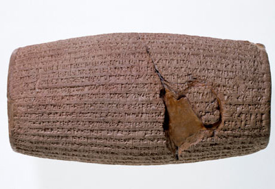
The Cyrus Cylinder

It was not an easy decision for the British Museum to lend one of its most treasured artefacts to a country which has a notoriously prickly relationship with the UK. So curators in London are paying close attention to an Iranian threat not to return the famous Cyrus Cylinder — now embroiled in political intrigue in the Islamic Republic.

The 6th century BC Babylonian object, sometimes described as the world’s first human rights charter, arrived in Iran at the weekend and is due to be displayed for four months at the national museum.

In a ceremony on Sunday President Mahmoud Ahmadinejad draped a Palestinian-style keffiyeh scarf worn by Basij militiamen over the shoulders of a bowing actor dressed as Cyrus. He also described Cyrus reverentially as “King of the World” – a striking phrase in a country where pride in Iran’s pre-Islamic past, encouraged by the shah, has been downplayed since the 1979 revolution. For Ahmadinejad’s domestic enemies, this was another glaring example both of his self-promotion and a religious-nationalist agenda that arouses their deepest suspicions.

“Isn’t it correct that the Cyrus Cylinder belongs to Iran?” asked the Keyhan newspaper, mouthpiece of hardline conservatives. “Isn’t it true that the British government stole this valuable and ancient object of ours? If the answer to these questions is positive, which it is, why should we return [it] … to the party which stole it.”

The correct answer, insists the British Museum, is that the cylinder was not stolen but excavated in Babylon, Iraq in 1879. Its loan was a triumph of cultural diplomacy for Neil MacGregor, the museum’s director, after relations between London and Tehran were strained to breaking point with the expulsion of British Council staff from Iran, the launch of the BBC Persian TV channel, and the violent and repressive aftermath of last summer’s disputed presidential election.

The loan reciprocates those made by Iran’s national museum to the successful Forgotten Empire and Shah Abbas exhibitions at the British Museum.

The cylinder is due back in Bloomsbury in January. “There is no sense that this is anything other than a loan,” said a museum spokesperson. “This is part of our ongoing relationship with the national museum of Iran which both institutions value as a cultural dialogue independent of political difficulties.”

But it seems destined to be the centre of controversy for as long as it stays in Tehran. Elyas Naderan, a fundamentalist MP, criticised the government for inviting British ambassador Simon Gass to Sunday’s reception.

Ayatollah Makarem-e-Shirazi, an influential cleric, denied rumours that he wanted to see the cylinder. “He never visits any exhibition apart from Qur’anic ones,” a statement said.

Critics on the left point to the irony of the president’s celebration of the cylinder as “a charter against injustice and oppression” as he oversees unprecedented human rights abuses. The opposition Jaras website called the object “a stranger in its own home”. Cyrus would have been shocked to hear Ahmadinejad invoke his name, it said.

“Ahmadinejad was apparently trying to appeal to a new constituency among non-political types and tap into discontent with the clerical establishment, while at the same time trying to keep his hard-line supporters happy,” commented Golnaz Esfandiari in her Persian Letters blog.

Read the full article here, including a history of the Cyrus Cylinder.

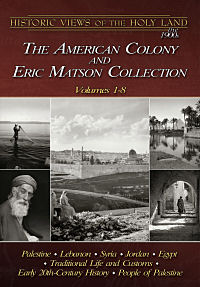
Recommended: Historic Views of the Holy Land – The American Colony and Eric Matson Collection

I felt like a kid in a candy store when I viewed the “American Colony and Eric Matson Collection” of more than 4,000 photographs of sites and scenes from Palestine (as Israel was called then), Lebanon, Syria, Jordan and Egypt.

This collection is part of the “Historic Views of the Holy Land” series produced by Todd Bolen of BiblePlaces.com.

Founded in 1881 by Horatio Spafford (author of the famous hymn, It is Well With My Soul), the American Colony in Jerusalem operated a thriving photographic enterprise for almost four decades. Their images document the land and its people, with a special emphasis on biblical and archaeological sites, inspirational scenes, and historic events. One of the photographers, G. Eric Matson, inherited the archive, adding to it his own later work through the “Matson Photo Service.” He eventually donated all the negatives to the U.S. Library of Congress, which has made them available to the public.

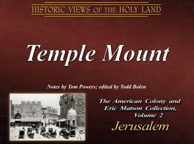
My attention was immediately drawn to Volume 2: The Temple Mount and it was exciting to see pictures of views that cannot be seen anymore or of places that are now inaccessible. I have been in most of the underground places on the Temple Mount, such as the Golden Gate, the Double and Triple Gate passages and Solomon’s Stables, but was never able to enter the interior of Barclay’s Gate. It was therefore fascinating to see pictures taken in the 1940’s of the interior and see the views which I only knew from the survey drawings of Charles Warren. Each photograph is described by Tom Powers and his comments are very helpful.

The Temple Mount - The American Colony and Eric Matson Collection

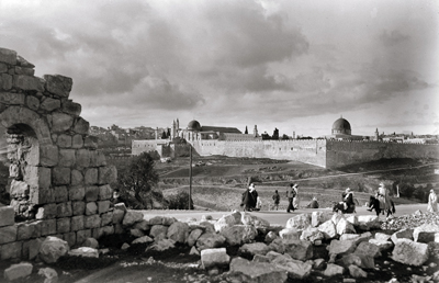
While working on the Temple Mount excavations in the 1970’s, we were excited to discover what was below ground, not giving much thought to what the site looked liked before the first pick was raised to break the ground. Seeing the “Southern Side of the Temple Mount” in a photograph taken sometime between 1989 and 1946, reminded me of how much has been discovered in the excavations, led by the late Prof. Benjamin Mazar between 1968 and 1978.

South Side of the Temple Mount - American Colony and Eric Matson Collection

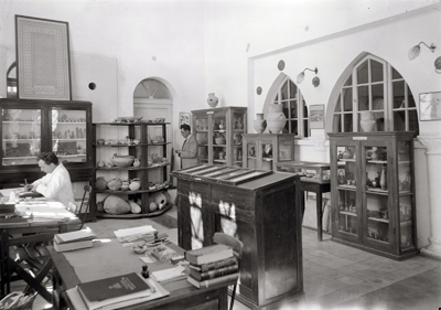
In the photographs of the Hebrew University, there are pictures of people whose names we are familiar with, but we do not always know their faces. Here you can meet Lord Balfour, Sir Herbert Samuel, Chancellor Judah Leon Magnes and Eliezer Sukenik, the father of the late Yigael Yadin. In another album you can meet General Edmund Allenby, who entered the city on foot through Jaffa Gate, ascended the steps of the Citadel and read a proclamation to the inhabitants of Jerusalem.

Prof. Eliezer Sukenik (center), the father of the late Yigael Yadin at the Hebrew University - The American Colony and Eric Matson Collection

Having lived many years in Jerusalem, I know the city very well, but it is amazing to see views of Jerusalem, taken 100 years ago. It is like a time machine, going back a century. Anybody interested in the history of Jerusalem would enjoy seeing these views. Although I would naturally focus on Jerusalem, the two CDs contain many interesting photographs of other parts of the Land and the surrounding countries. The album “Traditional Life and Customs” documents agriculture, home life and religious life of the different communities living in the Land.

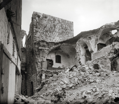
There are photographs of the devastating earthquake of 1927 that ruined many buildings from Jericho to Jerusalem, of World War I, the Arab riots of 1929 and British personalities who were involved in the Mandate. It is possible to study the turbulent history that led up to the establishment of the State of Israel in 1948 by viewing this fascinating collection.

Building in Jerusalem damaged by the earthquake of 1927 - The American Colony and Eric Matson Collection

Every photograph has been labeled and there is an extensive bibliography on the DVD, but most interesting is the file called “Jerusalem’s American Colony and its Photographic Legacy” by Tom Powers. It has profiles of people who lived in the American Colony, specially the Spafford and Vester families and the photographers that built up this irreplaceble collection.

Many of the photographs were taken by Eric Matson, who came to Jerusalem in 1896 and moved to America in 1946. As mentioned above, in his later years he donated the whole of the photo archive of the American Colony to the U.S. Library of Congress. The pictures can be downloaded from the website, but, having done it myself several times, I know that it is a laborious process. We can be thankful to Todd Bolen for having made the most interesting of these photographs available in an easily accessible format.

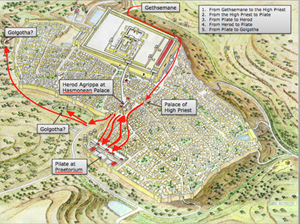
The Way to Golgotha in Jerusalem

Feedback from customers who have purchased our new CD Volume 2: “Jerusalem in the time of Christ,” has been very positive, indicating that you have found it a really useful aid in understanding and teaching this topic. You can see a taster below of the final slide in the set. It shows the culmination of a series of five slides, each one building on the next and indicating a stage in The Way to Golgotha – Christ’s last journey in Jerusalem. Stages shown are:

From Gethsemane to the High Priest
From the High Priest to Pilate
From Pilate to Herod Antipas
From Herod Antipas back to Pilate
From Pilate to Golgotha

Five stages in the Way of the Cross

The traditional Via Dolorosa or Path of Sorrows was fixed by monks in Western Europe in the eighteenth century and a devotional procession along this route is still led by Franciscans every Friday. In fact, the streets upon which Jesus walked lie about 10 feet below the level of these thoroughfares. By contrast, The Way to Golgotha is firmly based on Scriptural and archaeological evidence, with the claims of the two alternative sites for the crucifixion clearly evaluated.

The Destruction of Jerusalem’s Temple and Rome

Archaeologists hope to find more pieces of the ancient Forma Urbis Severiana, a marble map that was attached to the wall of the Temple of Peace in Rome. A plan of the city during the time of the Roman Emperor Septimius Severus (193-211 AD) was incised on 150 marble slabs, arranged in eight rows and covering an area of 60 by 43 feet. It shows in astounding detail the layout of streets with housing insulae, temples, bath houses and commercial areas.

Several pieces of the world’s oldest and largest unsolved jigsaw puzzle, a 2,200-year-old map of Rome made of thousands of marble fragments, could be unearthed next year following construction work for a new metro line near Rome’s majestic forum area.
“This is a unique occasion to excavate the Forum of Peace, where the map once stood,” Rossella Rea, director of the Colosseum, told the Italian financial daily “Il Sole 24 Ore.”
Carved into marble slabs around  210 A.D., during the rule of the emperor Septimius Severus, the map was originally hung on a wall in the Templum Pacis (Temple of Peace), which stood in the middle of an enclosure called Forum of Peace.
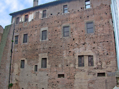
The wall still survives today in a building near the 6th-century Church of Santi Cosma e Damiano. Rows of holes where the map was attached using bronze clamps can still be seen.

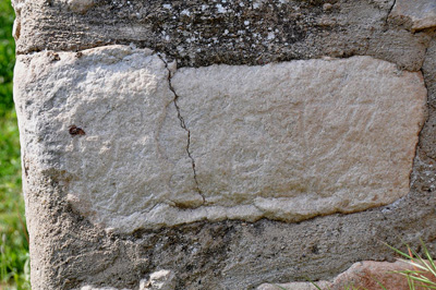
Surviving wall of the Temple of Peace. Bronze clamps were fixed in the holes of the wall to keep the marble slabs in place

Reporter Rossella Lorenzi mentions the fascinating connection with the destruction of the Temple of Jerusalem in 70 AD:

The centerpiece of the Forum of Peace was indeed the temple. Built in 71-75 A.D by Vespasian, the Temple of Peace celebrated the brutal pacification of the Jews and the destruction of the Temple at Jerusalem in 70 A.D.
Tons of gold, silver trumpets and gold candelabra were plundered from the Jerusalem temple and paraded through Rome’ streets in triumph.
The moment was captured in a frieze carved into the Arch of Vespasian’s son, Titus, which clearly shows the menorah, the seven-branched temple candelabra that was the symbol of ancient Judaism, being exposed through the streets.
Between 75 A.D. and the early 5th century, the treasure, which helped finance the building of the Colosseum, was put on public display right in the Temple of Peace.
Although it is unlikely that fragments from the treasure are unearthed, the archaeologists hope to bring to light other precious remains from the Forum of Peace.

Marble pieces from the Forma Urbis Severiana - the Plan of Rome in about 210 AD

HT: Joe Lauer

Jerusalem in the time of Christ – New CD-Rom

Conveniently timed to coincide with the beginning of the academic year, our new CD-Rom is now available. We promised to bring out our immensely popular slide set, “Jerusalem in 30 A.D.”, in digital format and we hope you will be pleased with the result. Re-named “Jerusalem in the time of Christ”, this CD has a bumper 85 pictures, as compared to the original slide set’s 36.

Volume 2: Jerusalem in the time of Christ

The advances of the digital age allowed us to focus much more on the city that Jesus knew. New drawings have been specially made in order to assist the viewer in opening a door to this historical world. One of our favourite new drawings shows a reconstruction of a small aedicule depicting the snake god of healing, Asclepius, found at the Pools of Bethesda. This find movingly reminds us how appropriate it was for Jesus to heal the paralytic man at this pagan healing centre, decisively refuting the claims of the serpent god.

The classic reconstruction drawing “Jerusalem in 30 A.D.,” which originally took 3 weeks to make, has been used as a base on which to create a ground-breaking series of slides showing The Way to Golgotha. Each of these five slides shows a stage in Christ’s last journey, beginning at Gethsemane and culminating at either of the two sites identified as the place of the empty tomb.

Other locations depicted include the Pool of Siloam (including the latest discoveries), the Essenes Gate, the Praetorium and Solomon’s Porch on the Temple Mount. Each picture is accompanied by a fully descriptive caption, with Bible references, allowing you to resurrect the place and period and to see for yourself how firmly the Gospels are rooted in the actuality of Jerusalem.

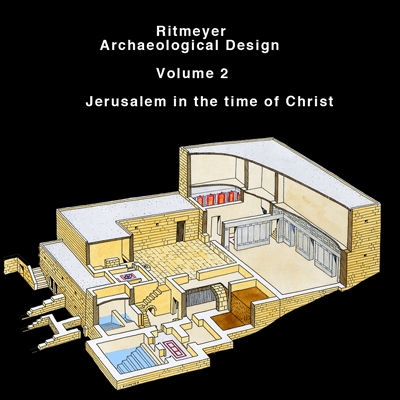
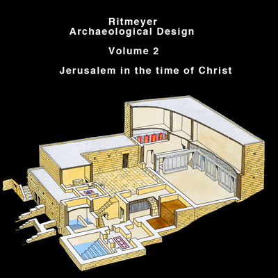
For those of you who may be wondering, the new cover illustration shows a reconstruction of the sumptuous mansion identified as having belonged to the High Priest Annas and the likely site of Peter’s betrayal of his master.

New RAD Web Design

Thanks to our web designer we have been able to revamp our website and we hope you like the new design. A reconstruction drawing of the Eastern Wall of the Herodian Temple Mount with the Temple appears in the header, which we plan to eventually rotate with other designs.

The upgrade is not meant to be a pretty face only, but we hope to put more information on the site. We have started with our new Showcase, giving you an idea of the projects we have been involved in over the last few years. Please have a look …

We also plan to list reviews of books, movies and software which we have found particularly helpful for students of Biblical Archaeology.

We are even more excited about putting up an archive with photographs of archaeological sites and reconstruction models and also, of course, reconstruction drawings. Thumbnails of the illustrations will be available for all to see, with an option to buy low resolution pictures for Powerpoint presentations and high resolution ones for publishers.

Many of you have asked why Vols. 2 and 3 are missing from the list of available CD-ROMs. Well, you won’t have to wonder much longer, as we are about to release these volumes. Volume 2 is called Jerusalem in the time of Christ:

Cover for Volume 2: Jerusalem in the time of Christ

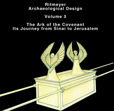
Volume 3 is called The Ark of the Covenant – Its Journey from Sinai to Jerusalem, and we will let you know as soon as they are available.

Cover for Volume 3: The Ark of the Covenant - Its Journey from Sinai to Jerusalem

Many years ago, we produced slide sets on these subjects and now the time has come to go digital. Whereas the two slide sets contained only 36 slides, the new CD-ROMs will have many more, with new digital or digitally enhanced pictures.

Another presentation on the Seven Churches of Revelation is also in the works.

First Temple period wall found in Jerusalem – revisited

One of my blog readers, Arthur Chrysler, made the following comments on a previous post, which I would like to share with other blog readers:

The Large Tower, explored by Warren and one hundred years later by Dame Kenyon, is constructed of stones of the character identified as Phoenician at Samaria. The header-and-stretcher construction is also identified as Phoenician at Samaria. Kenyon stated, “The date of these earliest walls, on the basis of the deposits against them, is, on the field estimate of the pottery, eighth century B.C. OR EARLIER (Digging up Jerusalem p.115). She also states in the caption under pl. 38, “Wall in Site S II on eastern crest of eastern ridge, which can be STRATIGRAPHICALLY dated to 8th century B.C….”. This area of Jerusalem is not a Tel! You cannot stratigraphically date anything here. This unique topography, consisting of a steep slope with exposed bedrock demands unique methodology. Kenyon states that, “Close at hand, there was a wall of the time of Solomon, from which the builders of the eighth century B.C. derived their stones”. King Hezekiah had a unique style of construction as seen in the Broad Wall, the Outer Wall, and his section of wall cutting across the Jebusite angle above the Gihon Spring. None of these examples give a hint of header-and-stretcher characteristics. Why would Hezekiah go through the trouble of re-stacking Solomon’s massive stones to move the tower only a few meters? Kenyon used the dating method that she was familiar with but it led her to the wrong conclusion regarding the tower here. The tower is certainly Solomonic and the connected wall and the Golden Gate, all of which display Identical characteristics.

If it is true that nothing can be dated stratigraphically in this part of Jerusalem, how can you then insist on a Solomonic date for the wall in Kenyon’s site SII and Benjamin Mazar’s Field 23? Kathleen Kenyon excavated down to the bedrock in this area and indeed concluded that:

“Beneath … the Byzantine wall … is a wall which probably belonged to a projecting tower. The date of these earliest walls, on the basis of the deposits against them, is … eighth century B.C. or earlier.” “… these walls were constructed of re-used stones … with irregular projecting bosses having margins on one, two or three sides.”

If these stones are indeed in secondary use, which I am not convinced of, it is possible that these are rejects or surplus masonry from Hezekiah’s square Temple Mount construction.

If you would examine the elevation, section and Isometric drawing of the Ophel Wall on Warren’s Plans, Elevations, Sections, etc., (1884), Plate 40, then it is clear that this L-shaped wall is built against an earlier wall and one can still see today that two different First Temple period building phases are represented in this area. That is why Warren called this wall section the “Extra Tower” or “Corner Turret”, i.e. it is a tower that was later added to strengthen an earlier fortification or part of the city wall. If the L-shaped wall, as you insist, is Solomonic, does that make the wall against which it is built Canaanite? If there are two construction phases in a building, that is called stratigraphy, showing that one wall is earlier than another. This stratigraphy is not different from that on a tell. This picture shows that the stratigraphically four building constructions can be identified:

1. The Byzantine Tower
2. Excavating inside and below the Byz. tower, a Herodian mikveh was found that was built against the inside wall of the “Extra Tower” (not visible in the picture)
3. The 8th century L-shaped “Extra Tower”
4. The pre-8th century wall against which the “Extra Tower” was built, which may be Solomonic if that can be proved conclusively.

Kenyon dated this L-shaped corner construction to the eighth century B.C. or earlier, but that does not necessarily mean that it is Solomonic. You compared it with the Phoenician masonry in Samaria, but that dates to the 9th century and is not Solomonic. A similar style masonry has been found in the sanctuary walls in Tel Dan, which is also post-Solomonic. I had suggested that there is an historical link between the “Extra Tower” and the masonry near the Golden Gate, but neither of these two constructions can be Solomonic.

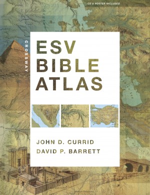
ESV Bible Atlas by Crossway

A few months ago, we received a pre-press copy of the ESV Bible Atlas to review:

Already then, we were very impressed with this atlas and wrote the following endorsement:

“I had the privilege of being involved in the production of drawings based on the latest research for the ESV Study Bible. It is a joy to see these drawings plus the original ESV Study Bible maps, woven together with numerous new maps, brilliantly evocative photographs and useful indexes to make up the new Crossway Bible Atlas. This volume will become an indispensable companion for Bible students, fulfilling every expectation you might have of such a tool. Particularly innovative is the use of terrain imagery to facilitate the reader’s understanding of such Biblical viewpoints as that of Abraham from Hebron over the cities of the plain or Moses from Mt. Nebo.”

Justin Taylor, who was the managing editor of the ESV Study Bible, wrote this in his blog:

“One of the neat things for me is being able to see the ESVSB illustrations—of the tabernacle, the temples, Jerusalem at various times, etc—in great detail over a two-page spread on glossy paper.”

We agree that on this glossy paper, the reconstruction drawings look even better than in the Study Bible. We are further told that

The new Crossway ESV Bible Atlas (352 pages) will be shipping soon from Amazon.

The text of the Atlas was written by Professor John Currid (RTS-Charlotte, NC). The maps were done by David Barrett, who also served as the cartographer for the ESV Study Bible. Here’s what it contains:

175 full-color maps
70 full-color photographs
3-D re-creations of biblical objects and sites
indexes
timelines
65,000 words of narrative description.
“The atlas uniquely features regional maps detailing biblically significant areas such as Egypt, Mesopotamia, Italy, and Greece. It also includes a CD with searchable indexes and digital maps, and a removable, 16.5 x 22-inch map of Palestine.”

You can flip through some of its pages here

As he lives in the USA, Todd Bolen received his copy yesterday, we can’t wait to receive ours in the UK soon as well.

Visit to Turkey

Apologies for my failure to blog in recent months. A research visit to Turkey and its subsequent recording, together with protracted happy family celebrations, account for this. Hope to make the results of our research available for educational use in the near future. In the meantime, however, must just mention the uncanny experience of finding myself in a site which I had drawn up from a distance some 15 years ago.

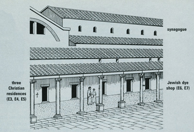
In 1996, Hershel Shanks, Editor of Biblical Archaeology Review, asked me to illustrate an article by John S. Crawford, entitled “Multiculturalism at Sardis” (BAR, Sept/Oct 1996 pp. 38 – 47). This involved drawing up a complex dating from the Byzantine period, which had been excavated in the city (originally mentioned as one of the 7 churches of Revelation). The complex comprised a colonnade of shops, some owned by Jews and some by Christians, an adjacent synagogue and adjoining this, an elaborate bath-gymnasium, with a marble forecourt:

He also requested a detailed drawing of the shops, where symbols carved on the stones revealed the differing religious affiliation of the owners. The whole point of the article, was, as its title implies, to show how Christians and Jews lived in Sardis side by side, in full tolerance of each other. I distinctly remembered drawing the two menorot incised on the doorjamb of the shop identified as belonging to Jacob the dyer. On the drawing, the two menorot are drawn on the outside of the shop, although in reality they are carved on a stone of the inside door jamb:

On our recent visit to the site, however, there was no indication of these evocative symbols, only numbers labelling each shop. Knowing that they must be there, we peered and felt around and it was deeply satisfying to find one and then another lampstand carved into the stone, just as I had drawn them up from original photos, taken by the Harvard-Cornell excavations in the 1960s and 70s. A large menorah can be seen on the right side of the stone, while a smaller one is visible to the left of the same stone:

We were blown away by the richness of Turkey’s Biblical heritage and are astounded at the recent direction taken by the country. Whither the “Other Holy Land?”

GLO Easter Experience

The new digital GLO Bible illustrates the events surrounding the Passion Week of Jesus Christ with samples of the media that accompanies scripture. Some of the reconstructions and animated maps that are shown are based on designs by Ritmeyer Archaeological Design:

The Palatial Mansion, excavated by Prof. Nahman Avigad in the Jewish Quarter of the Old City of Jerusalem, may have been the Palace of the High Priest where Jesus stood before Caiaphas, the son-in-law of Annas.