Description
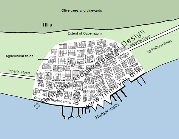
This is a schematic map suggesting the extent and layout of Capernaum. The village is located between the Sea of Galilee and the hills to the north. The village stretches for 300m along the shore and measures about 200m from north to south. The Imperial Road, which connects Capernaum with the Via Maris in the west and in the north, runs through the centre of the village, with the synagogue at its centre.
The village was probably divided into 4 quarters by the main north-south and east-west streets, with two sections of fishermen’s houses situated on either side of the Cardo, close to the sea and harbour. Wealthier houses, such as the ones belonging to the centurion, the ruler of the synagogue and the tax collector, were located closer to the hills, away from the harbour.