Shiloh

The place where the Tabernacle stood

At present, renewed excavations are being carried out under leadership of Dr. Scott Stripling, on behalf of the Associates for Biblical Research (ABR). He said that he answered the call of the prophet Jeremiah, who wrote: “Go now to my place that was in Shiloh … and see! (Jeremiah 7:12) – and so he did!  What do we know about Shiloh and what did he and his team find?

Shiloh seen from the north. Drone picture by Gregor Brandson. Used by permission.

Certain places have a soul-stirring quality about them and on visiting them, you feel you are walking through shades of history in company with those who walked before you. Shiloh is one such place. To go back in time to this site that was so significant in the early history of Israel and in the lives of biblical characters such as Hannah and Samuel, is an exciting experience. No other biblical site has a geographical location so accurately described as that of Shiloh. According to Judges 21:19:

Shiloh, is north of Bethel, on the east of the highway that goes up from Bethel to Shechem, and south of Lebonah.” 

These directions could be followed today on a GPS or road atlas. Using this description, the American philologist E. Robinson, was able to identify Shiloh with Khirbet Seilun (Tel Shiloh) as early as in 1838, as it matches this geographical description exactly. Ancient sources such as Eusebius and Jerome confirm the accuracy of the identification. Today, this road on which Shiloh is located, is called Highway 60. It is nowadays also called the “Route of the Patriarchs”, as it follows the path of the ancient road that ran along the Central Mountain Range from Hebron to Shechem, that features often in the travels of the biblical patriarchs.

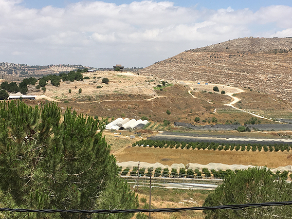
Shiloh in 1967. Photo: Leen Ritmeyer
Shiloh in 2019. Photo: Leen Ritmeyer

During the wars waged by the Israelites against the Canaanites in the heartland of the country, the Tabernacle and the Ark stayed in Gilgal. Then, we read in the Book of Joshua: “the whole congregation of the children of Israel assembled together at Shiloh and set up the Tabernacle of meeting there.” (Joshua 18:1)
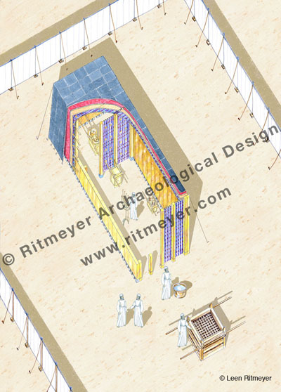
The Tabernacle was surrounded by an open court, formed by 60 pillars with silver capitals and linen curtains in between (Exodus 27). The Tabernacle itself stood at the back of this court with the Laver and the Altar of Burnt Sacrifices in front of it.
In this drawing, we see the inside of the Tabernacle. Inside the Holy Place was the Lampstand (menorah), the Table of Shewbread and the Altar of Incense. The Ark of the Covenant stood in the Holy of Holies.

In contrast to many of the sites we have encountered, the site of Shiloh is almost devoid of notable features. All that remains is a small tell of not more than eight acres, secluded at the end of a fertile and quiet valley in the heart of the hill country of Ephraim, (although a thriving Jewish settlement has taken root adjacent to the tell). It was most probably the very seclusion of this site that determined its choice as the new site of the Tabernacle. Here the allotment of territory to the various tribes could proceed unhampered by interference of the Canaanites who still held large areas in their possession further to the north, south and west. 
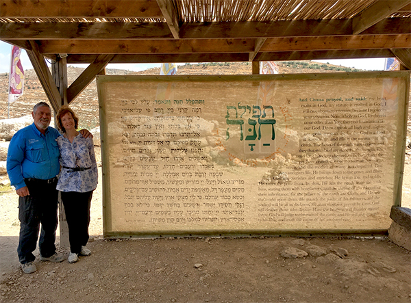
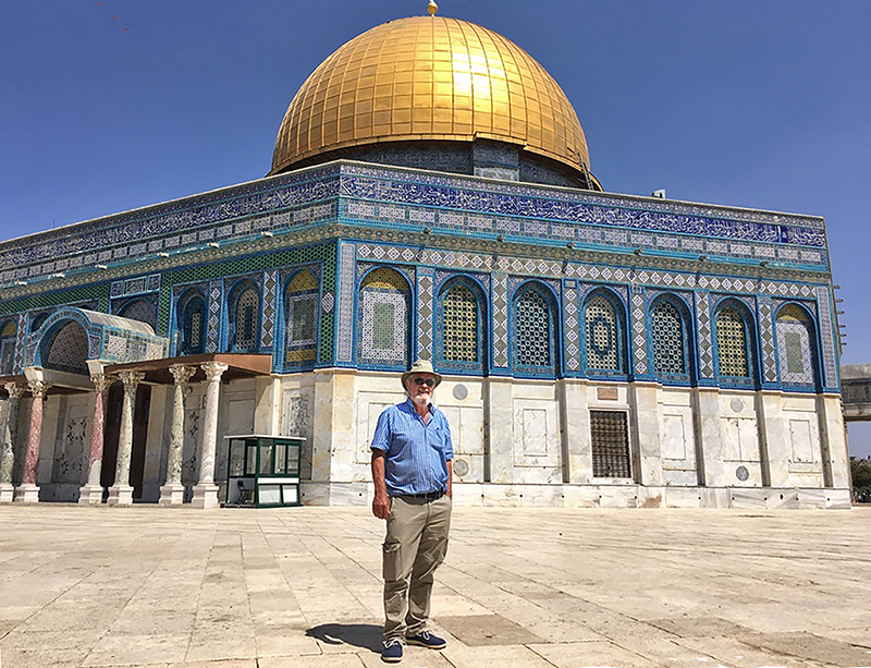
Leen and Kathleen standing next to a screen with Hannah’s Prayer in Hebrew and English.

Shiloh later became the permanent seat of the priesthood. The story of Hannah and Samuel in the first chapters of the Book of Samuel takes place against the background of Eli as High Priest. From these chapters, we get the impression that the Tabernacle was kept in some sort of permanent structure referred to as the “house of the LORD” (Hebrew – beth Yahweh) (1 Sam. 1:7,24 etc.), in contrast to the movable structure which was continually erected and dismantled during the wilderness wanderings. The Mishnah says as much:

 “After they came to Shiloh, the high places were forbidden. There was no roof-beam there, but below was a house of stone and above were hangings and this was the ‘resting place’ “ (Zebachim 14.6). 

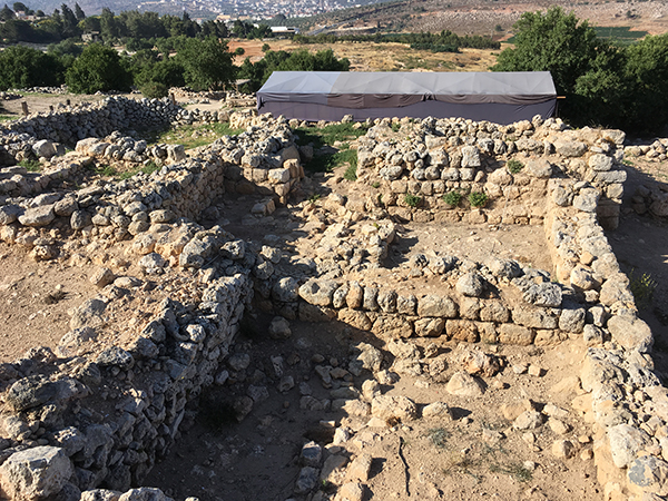
Tell Shiloh was first excavated by two Danish expeditions in the 1920’s and 30’s. Their excavations determined that the site was surrounded by a city wall in the Middle Bronze Age period, and had been destroyed by the Philistines in the mid-eleventh century BC. An Israeli expedition team led by Israel Finkelstein’s team in the 1980’s, made interesting findings on the west of the tell in their so-called Area C. Here they found, as shown in my reconstruction drawing, two Iron Age or Early Israelite buildings built against the outside of the Middle Bronze Age city wall.
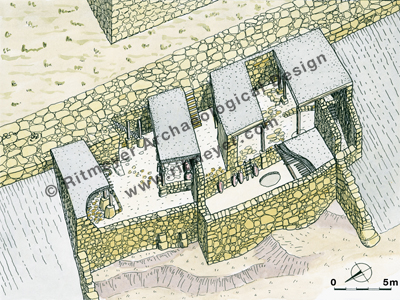
During the excavations in Shiloh, an Early Israelite house was excavated near the city wall. Evidence shows destruction by fire. The ritual nature of the objects found in the debris above the destruction level suggested a connection with a cultic complex, perhaps that of the Tabernacle that stood here during the time of the Judges.

These pillared buildings contained an abundance of early Israelite pottery with over twenty of the collar-rim jars (although of a different collar-rim type than the Bronze Age ones) that characterize Israelite settlement in this part of the Land. Evidence that the buildings of this period had been destroyed by fire, confirmed the conclusions of the Danish teams. Because of the ritual nature of the objects found in the debris above the destruction level of these buildings, it was suggested that they stood fairly close to a large structure of a cultic nature on the summit. Can we deduce from this that the Tabernacle stood on the summit?
On the summit of the hill, south of the circular visitors centre, is a flat area the size of the Tabernacle court. Was this the place where it stood beneath these later remains?

Certainty is impossible in view of the destruction of the earlier remains in this area. However, the identification of the tell of Seilun with ancient Shiloh is undisputed and these pillared buildings are authentic remains from the stirring times which saw the erection of the Tabernacle in its new home here in the mountains of Ephraim.
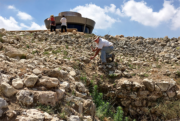
Scott Stripling driving in the first stake in 2016. Photo: Leen Ritmeyer

In June 2016, Scott asked me to help set out the excavation site and be the site architect. In the last three years of excavations, the team has revealed a large stretch of the Bronze Age city wall in the northern part of the tell. Digging between two previous excavations, the continuation of the 5.25m (10 cubits) wide city wall from the Canaanite period with storerooms on the inside, was traced. Storage jars and ritual objects were found in these rooms that were probably associated with a Canaanite temple that had stood at the summit of the hill. These storerooms were organised in units of three underground rooms with a narrower room on one side that served as an entrance from above. The remains of a nearby large structure are also being uncovered, in and near which Israelite sacred objects such as the horn of a stone altar and a ceramic pomegranate were found. 

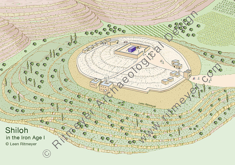
This is a reconstruction drawing of Shiloh during the time of Samuel, looking northeast. Already in the Canaanite period this site was used as a cult site for religious gatherings. The Tabernacle is shown on top of the hill, inside some sort of permanent structure, possibly the remains of a Canaanite temple courtyard. In the foreground, two Israelite houses are shown, built into the glacis and against the outside of the city wall. At its northern end are the storerooms and a large building, that at present is being excavated by the ABR team. © Leen Ritmeyer

The absence of houses and streets also indicate that this site was used as a cult site for religious gatherings. This site was abandoned at the end of the Middle Bronze Age, in about 1550 BC and remained virtually unoccupied until the end of the 13th century. This appears to have been the time when Joshua gathered the tribes to divide the Land. 

It would appear that Joshua took over this site and placed the Tabernacle there, presumably inside the remains of a Canaanite temple courtyard, as the linen curtains of the original court had probably perished by then. Indeed, the text of 1 Sam. 3:15 seems to indicate that this courtyard may have been replaced by a stone wall and possibly an entrance gate.  The cultic nature of the site made it therefore possible for the entire community of Israel to gather here for the division of the Land.

It would be wonderful if the location of the Tabernacle site could be determined. 

After the Philistine disaster, the Tabernacle was moved first to Nob and then to Gibeon. Scott’s team is not looking for the remains of the Tabernacle itself, of course, but perhaps some remains of the courtyard in which it stood may have survived. Keep digging Scott! 

“Here, in this carved-out place, stood the Ark of the Covenant”

So reads the headline in an Israeli newspaper reporting on an interview about the Temple Mount.

On the 11th of this month, I guided a group of Israeli visitors around the Temple Mount. All of them were highly interested in the Temple Mount for various reasons, some nationalistic and others religious. At the end of the tour, we had lunch together and a journalist interviewed me. His full-page report, with the above title, was published in the Hebrew Makor Rishon newspaper.

You can download the translation of this article with this link:

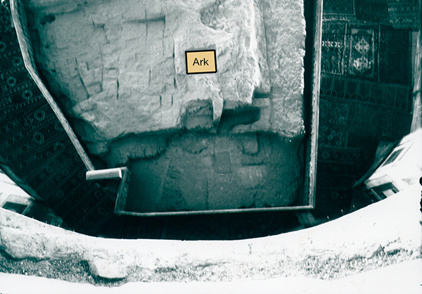
Their main interest was the location of the Temple and the Ark of the Covenant. And as we couldn’t enter the Dome of the Rock, I showed them an old photograph showing the indentation that King Solomon made for the Ark of the Covenant (1 Kings 8.21)

The location where the Ark of the Covenant stood.

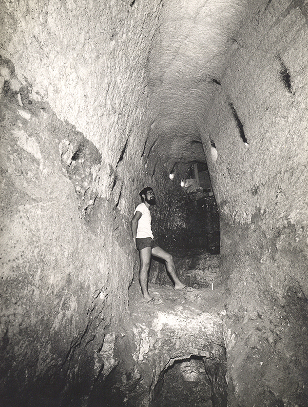
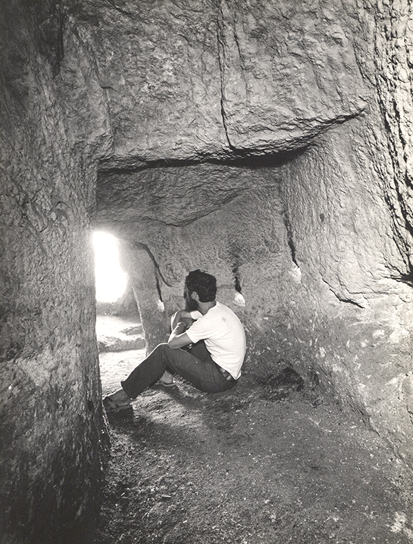
They were also very interested in the underground spaces beneath the mount and published in the newspaper a photograph of a tunnel that was found below the Triple Gate passageway. It was such a peaceful time in the 1970’s, that we had free access to these mysterious places. It was a real privilege to have seen, measured and photographed these spaces, something that would not be possible at present.

In the tunnel below the Triple Gate undeground passageway in 1974. The water that overflowed from an underground cistern was channelled out through this tunnel.

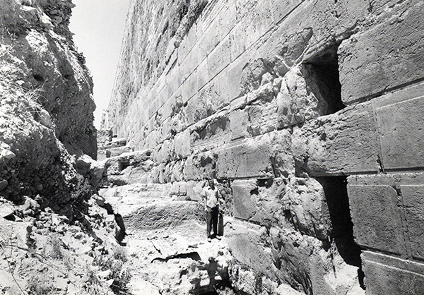
During that time, other tunnels were found running deep below the Double Gate. All these tunnels were closed off after thorough investigation.

This tunnel led from in front of the monumental stairway to the Double Gate to deep below the underground passageway of this gate.

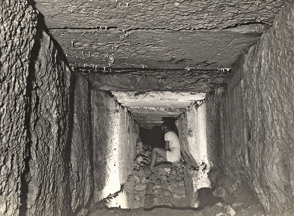
In between the Triple Gate and the southeast corner of the Temple Mount, below the Single Gate that dates from the Crusader period, is another secret tunnel that runs below Solomon’s Stables, that has been converted to a mosque, the El-Marwani Mosque. This tunnel reached to the centre of the Royal Stoa above and may have been used by the workmen who built this edifice.

The entrance to another secret tunnel that ran below Solomon’s Stables. This opening is now blocked up.
Inside the tunnel below Solomon’s Stables

Afterwards we talked about the significance of the Temple Mount for Israeli and non-Jewish people alike. For one of the group, the Temple Mount was of nationalistic importance. He had come from Persia, but the reason was to get to know Jerusalem and the Temple Mount, without which, according to him, Israel had no significance.

Another religious Jew said that he couldn’t keep the Mosaic Law without the Temple Mount. I had to agree and said:


“If I were a Jew, I would like to sacrifice the Passover sacrifice on the Temple Mount. Jerusalem has no meaning without the Temple Mount.
When I arrived in Israel in 1969, we lived in Gat Rimmon and rented a house from Russian immigrants who had lived in Israel for decades but never visited Jerusalem. I found that hard to understand. Why did you return here if not for Jerusalem and the Temple Mount?”

They wanted to know what, apart from its archaeological importance, the Temple Mount meant for me as a Christian. I answered that Mount Moriah was the place where Abraham was called to sacrifice his only-begotten son Isaac, which, as explained in the Letter to the Hebrews 11:19, was an example of the sacrifice and resurrection of Jesus Christ.

Is the Ark of the Covenant depicted on a carved stone at Capernaum?

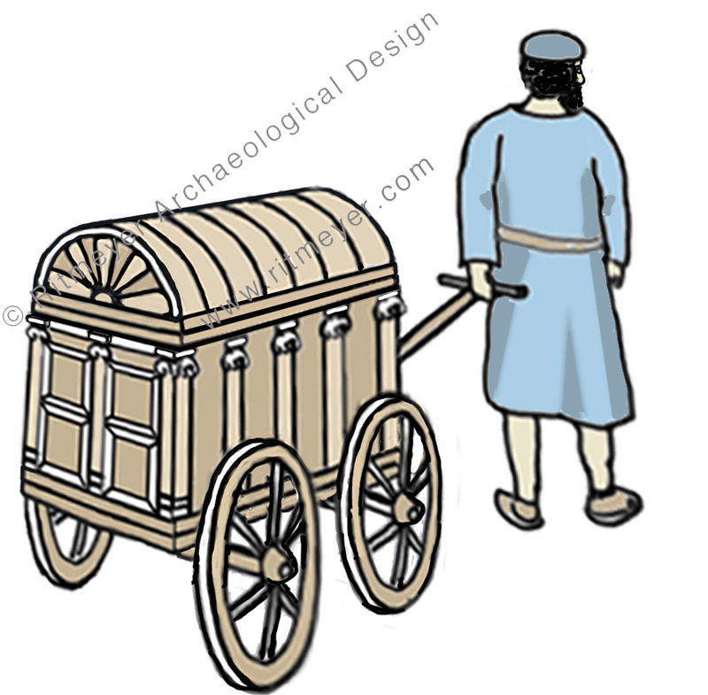
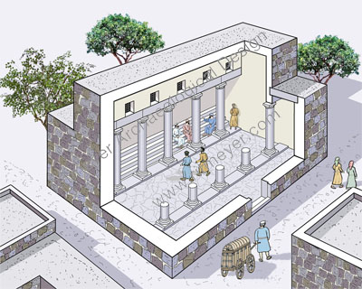
The reconstruction drawing that illustrated our previous post, which described the 1st century synagogue of Capernaum, includes a figure pulling a small ornate carriage towards the entrance of the building.

The 1st century Synagogue of Capernaum where Jesus preached. In the foreground we see the ruler of the synagogue bringing the Torah Scrolls in a chest on wheels, called the Holy Ark. © Leen Ritmeyer

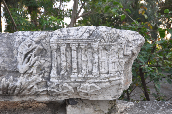
Is this vignette just an artistic flourish or does it have a historic basis? In this post, we hope to show that ancient sources and evidence from one of the architectural fragments found scattered on the site of Christ’s “own city” (Matthew 9.1), make it reasonable to assume that such a device was once used to transport the precious scrolls of the Law to the synagogue from a place where they were stored safely.

But firstly we must release the element (pictured below) from the layers of misidentification it has accrued since it was first displayed on a wall by the Franciscan custodians of the site, together with other elements of a frieze that originally adorned one of the walls of the later (Byzantine) synagogue.

A carved stone on a frieze that came from the Byzantine Synogogue in Capernaum shows a wheeled shrine, decorated with a double winged panelled door, topped by a scallop. The side has five pillars as in an Ionic temple, while the roof is convex. 

I have lost track of the number of times, on visits to the site, that I have heard tour guides explain to their group: “this is a model of the Ark of the Covenant made by Moses and carried for 40 years in the wilderness.” A well-known tour company has a photo of this stone on their website with the caption “Stone carving of Ark of the Covenant at Capernaum” (now amended since this post) and this is repeated many times, for example by Tripadvisor.

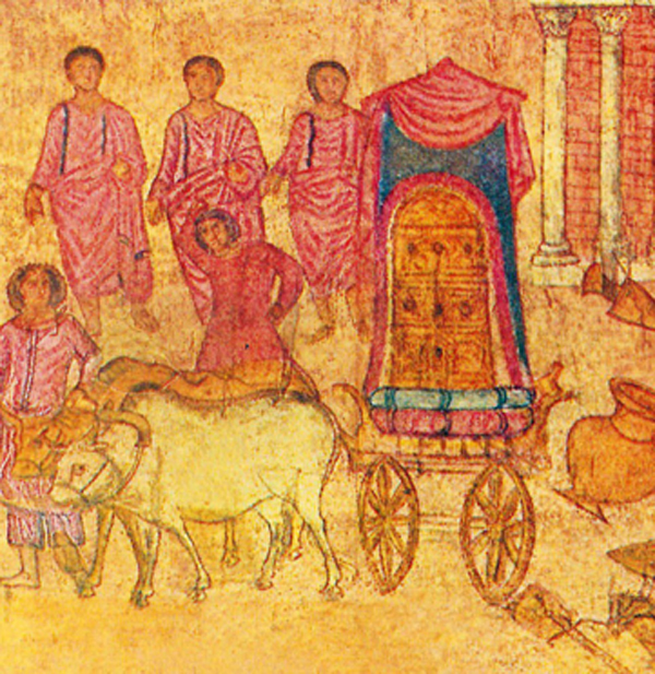
An easy explanation – but could it be true? Opinions vary greatly, even among scholars. This is partly due to the lack of comparative material. There is one illustration from the Dura Europos Synagogue that shows the Ark on a wheeled cart, but that was the Ark of the Covenant as it was sent back on a cart by the Philistines (1 Samuel 6:7) and therefore cannot be used as a parallel:

This fresco from Dura Europos shows the Ark of the Covenant placed on a cart by the Philistines.

There is an insight in the book “Capernaum” 1  by Sapir and Ne’eman (pp 63, 64) into the dichotomy between two religious requirements of the synagogue: “the first religious demand was – and still is – to focus the attention of the whole praying congregation on the Ark of the Law – (aron hakodesh) containing the scrolls of Torah. Another independent demand, no less imperative – was to orientate the synagogue toward Jerusalem” … “If the Ark were permanently built in the south wall or a little before it, the view towards Jerusalem would be blocked for ever. If, on the contrary, the Ark of the Law were arranged on the blind doorless north wall,the worshippers would have to turn their backs on Jerusalem -which was considered a blasphemy.”

 A passage in Mishnah Taanit 2:1 may explain how a solution to this problem was found: “They used to bring out the Ark [containing the Scrolls] into the open space in the town”. Although this was done during times of fasting, it nevertheless shows that the Torah scrolls were sometimes transported from a place, such as the home of the archisunagogos, as the ruler of the synagogue is called in the New Testament, to the synagogue and back again. Continue reading “Is the Ark of the Covenant depicted on a carved stone at Capernaum?”

The Synagogue of Capernaum in which Jesus taught

Was it white or black?

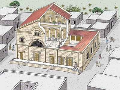
The best compliment I can receive about any of my reconstruction drawings is for the viewer to say: “It really makes the site come to life!” Unfortunately, the same cannot be said about photographs, however professionally taken. Take the site of Capernaum, perhaps the most visited site in the Galilee in any tour of the Land. Here, the place in which Jesus taught and in which he cast out an unclean spirit (Mark 1.21-28, Luke 4.31,32) is shown. It is all too easy to shoot photos of your group with the impressive synagogue structure emphasizing the magnificence of its architectural decoration and the dazzling white limestone from which it is built.

A cutaway reconstruction drawing of the 4th century Byzantine Synagogue of Capernaum.

But this then is the image you take away with you and the picture that springs to mind when next you read Jesus’ reference to the centurion: “he loves our nation and has built us a synagogue” (Luke 7.5).

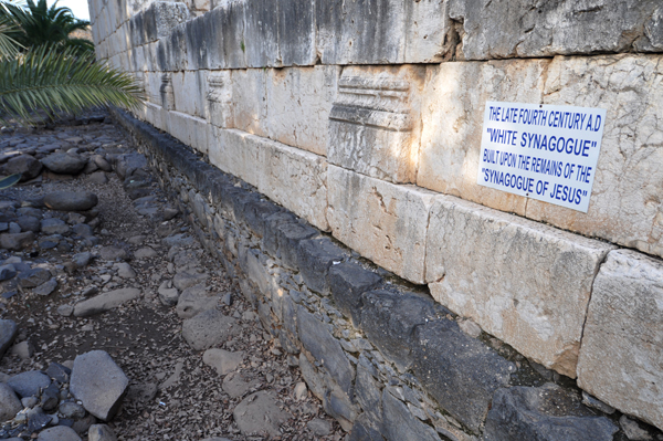
But look more closely beneath the ruins of the beautiful white synagogue and you will see that it rests on an older building made of dark stones.

The 4th century synagogue rests on the remains of the 1st century synagogue that was made of basalt stones.

What is the relevance of these? This is where the value of making reconstruction drawings can be shown, with the process allowing historical and archaeological information about the site to be presented in a meaningful way. Continue reading “The Synagogue of Capernaum in which Jesus taught”

The Temple Mount in the time of Solomon

As storm clouds gather over Jerusalem and the Temple Mount, we continue with our series on the development of Mount Moriah.

In our previous post, we talked about the locations of the Altar and the Holy of Holies. What happened after David built the Altar? After ruling seven years in Hebron, he made Jerusalem the capital of Israel. The first thing he did was bring the Ark of the Covenant from Kiriath-jearim to Jerusalem, the City of David. There it rested, presumably in a tent in the grounds of David’s palace, until circa 967 BC .

Here we see a reconstruction drawing of the Palace of King David. In the excavations of Yigal Shiloh, which took place between 1978-’84, a stepped stone structure was discovered that may have served as a foundation for David’s palace that stood higher up the hill. It stood behind the northern city wall and had rooms arranged round a courtyard. In the palace garden we see a tent for the Ark of the Covenant.

The Ark was then moved into the new temple that was built on Mount Moriah by Solomon, the son of David.

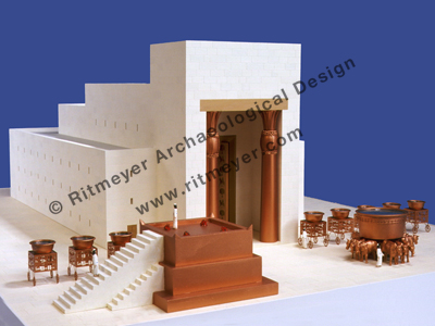
The design of this beautiful model of Solomon’s Temple is based on the description in the Book of Kings. The Temple had a high Porch, supported by two bronze pillars, called Yachin and Boaz. The inner sanctuary was divided into two rooms, the Holy Place and the Holy of Holies (Most Holy Place), where the Ark of the Covenant stood. A three-storey high structure surrounded the sanctuary. In front of the Temple stood the Altar, the bronze Basin (Sea) and ten smaller basins.

This sacred compound was surrounded by a wall that formed the Temple court.

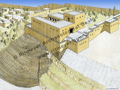
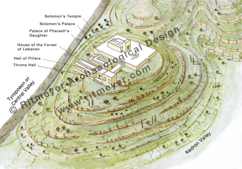
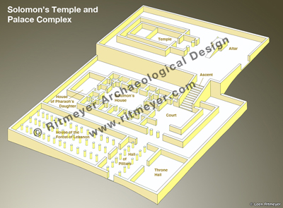
The Holy of Holies was placed on the summit of Mount Moriah, with the Temple facing east, toward the Mount of Olives. Solomon also built a palace complex adjacent to the Temple. It consisted of his armory, the House of the Forest of Lebanon, a Hall of Pillars, the Porch of the King’s Throne, the King’s House and the house of his wife, Pharaoh’s daughter. As our drawings concern Mount Moriah only, all other buildings and city walls have been omitted.

On the visit of the Queen of Sheba to Jerusalem (1 Kings 10), the Ascent which Solomon built from this complex up to the Temple, was one of the things that inspired her awe.

This schematic drawing shows an arrangement of the various buildings, based on parallels with similar complexes excavated elsewhere in the Middle East. From a large courtyard in front of Solomon’s House, a special Royal Ascent (1 Kings 10.5 KJV) led up to the Temple, which lay on higher ground.

For those of you who are interested, Carta very much hope to publish our guide book to the Temple Mount at the earliest propitious moment.

The first drawing in this series showed Mount Moriah itself.

The second drawing shows the Temple Mount in the time of the Jebusites.

Underground Battle for the Temple Mount

In today’s Makor Rishon (Hebrew) newspaper, Arnon Segal published an article, called Otiot porchot be-avir (letters blossom in the air). Based on the diary of the Rabbi of the Western Wall, Rabbi Meir Yehuda Getz, he retells the story of the underground excavations and the struggle that took place inside Warren’s Gate in 1981. Warren’s Gate is the northern-most of the four original Herodian gateways that gave access to the Temple Mount through the Western Wall.

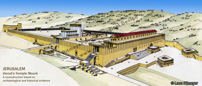
This well-known reconstruction drawing of the Temple Mount in Jerusalem during the Second Temple period is based on historical information and the results of the Temple Mount excavations, which were led by the late Prof. Benjamin Mazar from 1968-’78.
Herod the Great enlarged the existing Temple Mount to double its size and built a new Temple. In the Western Wall (left) there were four gates. Warren’s Gate is the northern-most gate in the Western Wall (on the left). The Southern Wall (right) had two gates. Above this wall stood the Royal Stoa. The Antonia Fortress at the northwest corner (far left) guarded the Temple Mount from the north.

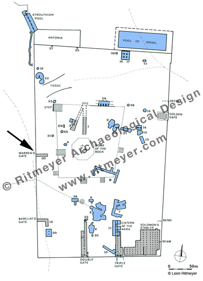
In April 1866, Captain Charles Wilson inspected this underground passageway which for several centuries had been used as a water reservoir. Three years later, Charles Warren examined the cistern (Cistern 30, see below) and noted that its western end pierced the Western Wall. It measures 25.6×5.50m and its floor is 10.50m below the level of the Temple Mount. This cistern was originally a Herodian underground passage, leading up from Warren’s Gate to the Temple Mount, possibly having an internal L-shaped stairway like at Barclay’s Gate. A relatively modern stairway descends from the west into the cistern. Wilson later named this gate after Warren.

This plan shows the cisterns (blue) and underground passageways (grey) of the Temple Mount. The numbering system was developed by Charles Warren, who, in the 1860’s, explored many of these underground structures. Some of these underground passageways were part of Herodian gates that gave access to the Temple Mount, i.e. Cistern 30 is the underground passageway of Warren’s Gate (see arrow), Cisterns 19 and 20 are part of the underground passageway of Barclay’s Gate, Cistern 1 is the underground passageway of the ancient Tadi Gate.
Some of the water cisterns, such as Cisterns 7 and 8 were enormous underground water reservoirs, capable of holding some 2 million gallons of water. Most of these cisterns were initially underground quarries from which building stones for the buildings of the Temple Mount were taken. After the quarrying activities were stopped, these caverns were plastered and became water reservoirs.

This underground tunnel was accidentally rediscovered in 1981 during excavations that took place along the Western Wall north of Wilson’s Arch. During the construction of an underground synagogue, workers broke through the wall that had blocked up the gate opening.

Rabbi Getz believed that this gate was used in the past by priests going up to the Temple. He also believed that this passage led to the lost Temple treasures and to the Ark of the Covenant. After working in secret for about a month, Arabs found out from a media report that the Israelis were excavating below the Temple Mount. They descended into the cistern through two manholes from above and closed off the gate with a very thick concrete wall.

The dream of Getz to reach the Temple Treasures, especially the Ark of the Covenant, was dashed. According to his diary, he sat down with ashes on his forehead, praying:    “O God, the nations have come into your inheritance; they have defiled your holy Temple.” (Psa. 79:1).

Despite the fact that this excavation was illegal, it nevertheless would have been exciting to find out more about how exactly this underground passage originally worked.

HT: Yisrael Medad

Music Festival at the home of the Ark of the Covenant in Kiryat Yearim

Kiryat Yearim is one of the most evocative Biblical sites in Israel and never more than during the Abu-Gosh Festival. Then, twice a year, at Succot and Shavuot, this Arab village in the Judean hills, where the Ark of the Covenant rested for 20 years (1Sam. 7:2) becomes the backdrop for Israel’s most important vocal music event.

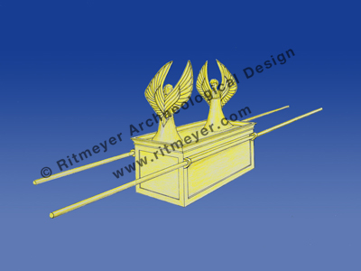
A representation of the Ark of the Covenant as described in Exodus 25.10-22. The Ark was a box made of shittim wood and overlaid with gold. It had a golden covering lid, called the mercy seat, out of which two cherubim were crafted. The two tablets of stone on which God had written the Ten Commandments were placed inside the Ark. The Ark was carried by two poles which were placed in rings fixed to the side of the Ark. © Leen Ritmeyer

The 12th century Crusader church at the heart of the village and the church of Notre Dame de l’Arche de L’Alliance (Our Lady of the Ark of the Covenant) at the top of the hill are the main venues because of their remarkable acoustics.

A video showcasing the site and the event can be viewed here.

The programme of the upcoming 40th festival is here. This is a previous blog post on the festival.

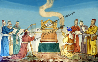
This painting hangs on the walls of the Church of Our Lady of the Ark of the Covenant at Kiriath Yearim in Israel. The Ark is in the centre of the painting with David playing on the harp to its left (2 Samuel 6). The High Priest with a censer of incense bows in reverence on the right. The memorial Name of God, Yahweh, is written between the two cherubim. © Ritmeyer Archaeological Design

Jesus’ Baptismal Site to open to the public

According to this Jerusalem Post report, the site where Jesus was baptised will be opened to the public in 10 days’ time, on January 18, 2011. See also Todd Bolen’s report here.

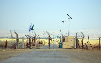
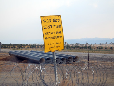
When we tried to visit the site last year, following the signs for Qasr el-Yahud, we found that the road was blocked by a military fence and gate.

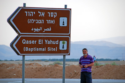
Leen at the road sign for the Baptismal Site

Military fence on the road to Bethabara

There was a sign which we ignored because we didn’t understand what “photgraphy” was!

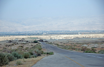
View of Bethabara from the fence

It will be wonderful to visit this site, which has been off-limits for 42 years. The site where Jesus was baptised is called Bethabara in John 1.28. The Hebrew name Bethabara means the “Place of Crossing”. Not only was it a suitable place where travellers crossed the River Jordan opposite Jericho, but the name also indicates that it was the place where the Israelites crossed over into the Promised Land after the death of Moses.

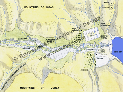
This drawing from our Image Library shows the location of the Camp of Israel in the Plains of Moab opposite Jericho (Numbers 33.48,49). Here, the scene is set for the crossing of the Israelites into the Promised Land. The place where they crossed the River Jordan is called Bethabara, where later Jesus was baptised (John 1.28).

The crossing of the Jordan is described in Joshua 3.15,16 (quotes from ESV):

“as soon as those bearing the ark had come as far as the Jordan, and the feet of the priests bearing the ark were dipped in the brink of the water (now the Jordan overflows all its banks othroughout the time of harvest), the waters coming down from above stood and rose up in a heap very far away, at Adam, the city that is beside Zarethan, and those flowing down toward the Sea of the Arabah, the Salt Sea, were completely cut off. And the people passed over opposite Jericho.”

The Ark Passes over the Jordan, by J. James Tissot (1836-1902)

Bethabara played an important role in the life of Jesus, as he returned there many times after his baptism. He went there, for example, after his rejection in Jerusalem during Hanukkah, the Feast of Dedication, “He went away again beyond Jordan into the place where John at first baptized; and there he abode.” (John 10.40). “Beyond Jordan” is, of course, also the place where the Camp of Israel was located just before they entered the Promised Land! Undoubtedly this site had a strong impact on the mind of Jesus as he would have been very familiar with the Biblical events that took place there.

After Jesus was baptised, he was tempted in the wilderness nearby. He used the words of Deuteronomy to counter the temptations of the devil. Moses wrote the Book of Deuteronomy while Israel was encamped “beyond Jordan” (Deut. 31.9).

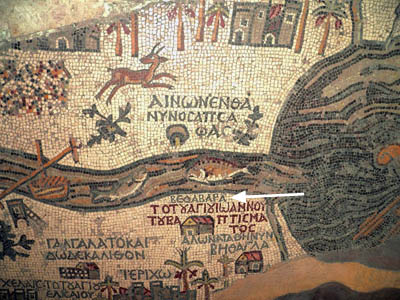
According to the Madaba map, Bethabara is on the west side of the Jordan (see white arrow)

After the crossing, Joshua commanded to take out 12 stones and place them in the next camping place, Gilgal: “these stones shall be for a memorial unto the children of Israel for ever” (Joshua 4.7). As John was baptising here, he probably referred to these 12 stones when he said: “God is able of these stones to raise up children unto Abraham” (Matthew 3.9).

Bethabara features again in the book of Judges. To complete his victory over the Midianites, Gideon:

“sent messengers throughout all the hill country of Ephraim, saying, “Come down against the Midianites and capture the waters against them, as far as Beth-barah, and also the Jordan.” So all the men of Ephraim were called out, and they captured the waters as far as Beth-barah, and also the Jordan. And they captured the two princes of Midian, Oreb and Zeeb.” (Judges 7.24,25).

This victory is reflected in a psalm when David longed for the victory over Israel’s future enemies “Make their nobles like Oreb and Zeeb”, looking forward to a time when their adversaries would be confounded forever (Psalm 83.11,18).

And there are still further references in Scripture to Bethabara: During the rebellion of Absalom, King David crossed here and returned later via the same crossing place:

“So the king came back to the Jordan, and Judah came to Gilgal to meet the king and to bring the king over the Jordan. ” (2 Samuel 19.15).

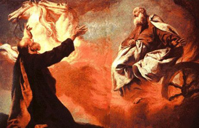
Bethabara is also the place where Elijah and Elisha went after leaving Jericho. There “Elijah went up by a whirlwind into heaven” (2 Kings 2.11).

Giovanni Battista's (1683-1754) painting of Elijah ascending in a whirlwind

A visit to this site will be a valuable addition to any tour of the Land. Needless to say, such a visit would be greatly enriched if it is with “Bible in hand”, in order to reflect on all the significant events that took place here. Hopefully I will be able to see the place from the other side, when I visit Tall el-Hammam in Jordan.

The Ark of the Covenant

With the conversion of our slide set, “From Sinai to Sakhra,” into digital format, the complete set of volumes we previously had available is now on disc. Having ourselves followed, in part, the route of the Ark and being intimately familiar with some of its resting-places, this subject is close to our hearts. Information that has come to light in recent years has been added, making this CD an entirely new presentation.


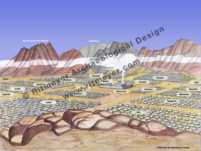
Pictures of a model of the Tabernacle, designed by Dr. Leen Ritmeyer, have been included to help viewers understand the place of the Ark in the symbolism of God’s desert sanctuary. Specially created maps of its journey to the Promised Land and wanderings among the Philistines make it possible to follow this dramatic story. There are unique reconstruction drawings of scenes such as the Camp of Israel at the foot of Mount Sinai and evocative photographs of the desert scenes through which the Ark passed. The view of Moses from Mount Nebo is contrasted with that of Balaam, the mad prophet, from the very same spot. A rare photograph of the River Jordan in flood serves to demonstrate the faith of the two spies who crossed it before the Ark could lead the Israelites into their inheritance.

Reconstruction drawing of the Camp of Israel at the foot of Mount Sinai - © Leen Ritmeyer

Excavation photographs and diagrams show that the walls of Jericho really did fall down! Once Jerusalem is reached, the cities of David and Solomon, which were so closely involved with the Ark’s stay, are explored both in photographs and graphics. The account of the travels of the Ark ends with the installation of this holiest of objects in the Holy of Holies of the Temple and a discussion as to its possible location today.

We have ideas for exciting new topics for CDs to aid you in your Bible study and teaching and will keep you posted on this blog. Do let us know if there is a subject you would like covered.

The Ark of the Covenant and Music Festival at Kiriath Yearim

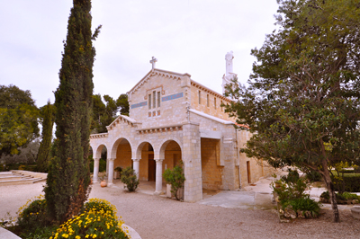
Working on what will be our CD Vol. 3 “The Ark of the Covenant – Its journey from Sinai to Jerusalem,” we are spending time in Kiriath Yearim, where the Ark was kept for twenty years before David brought it to Jerusalem. In the early part of the twentieth century, a determined French nun made the acquisition of this site on the outskirts of Jerusalem, the demonstration that it was the Biblical Kiriath Yearim and the building of a church, convent and retreat centre, her life’s work. She had the basilica built over the remains of a church of the fifth century, using the same quarry as the Byzantine builders. It turns out that the church is now recognised as having “arguably the best acoustics in the country!”

Church of Our Lady of the Ark of the Covenant, Kiriath Yearim


Having used the retreat centre as a Jerusalem-base for our tour group some years ago, we can testify to the sublime views from this hilltop site towards the city. If you are in Jerusalem, with Sukkot coming up, there is a not-to-be-missed opportunity to hear beautiful music performed in this church and also in the Crypt of the Crusader Church in the village of Abu Ghosh at the bottom of the hill. The programme of the 38th Abu Ghosh Vocal Music Festival is here, with further information on this site.