Description
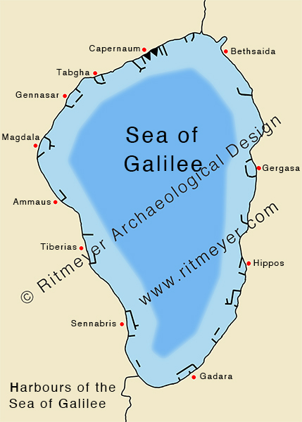
This map is based on observations made by Mendel Nun of Kibbutz En-Gev. During the severe droughts that lasted from 1989 to 1991, the water level of the Sea of Galilee dropped significantly. Several harbours dating from the first century were exposed by the retreating waterline, enabling Mendel to map them and add details to previously known harbours.


