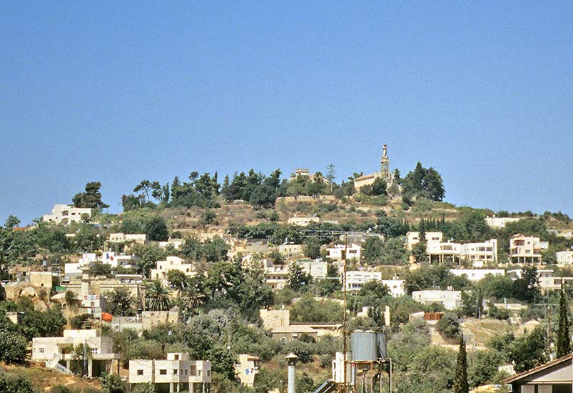
After its long journey in Philistine territory, the Ark was brought to Beth Shemesh. As some of the men there had looked into the Ark (1 Samuel. 6:19 ), a plague followed and the Ark was moved to Kiryat Ye’arim, one of the five cities of the Gibeonites (Joshua 9:17). The Ark stayed in Kiryat Ye’arim for twenty years. On top of the hill of Kiryat Ye’arim stands a church called Our Lady of the Ark of the Covenant Church to commemorate this event.
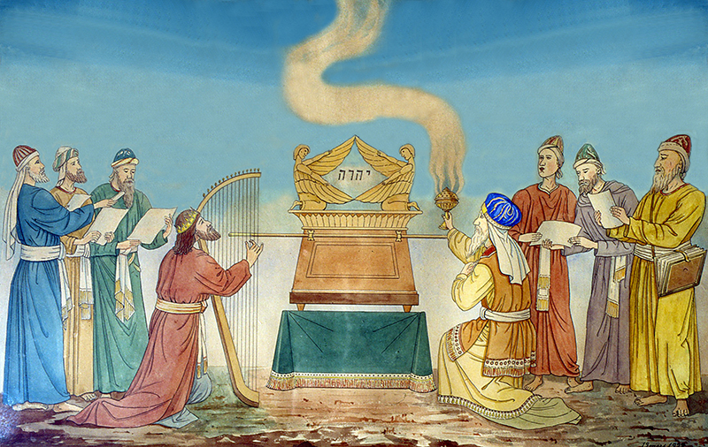
Inside the church is a painting showing King David playing the harp in front of the Ark of the Covenant. The name Yahweh is written in between the two cherubim.
King David initially copied the Philistines and transported the Ark on a wagon with disastrous results for Uzzah (2 Samuel 6:1-8). The Ark was then put in the house of Obededom the Gittite (2 Samuel 6:10). Three months later, after David heard that the house of Obededom was blessed, the Ark would have been carried, presumably on the shoulders of the descendants of Elizaphan, to Jerusalem. At that time, Shemaiah of the sons of Elizaphan was the chief (1 Chronicles 15:1-8) and he would have continued the task originally given to his forefather Elizaphan. This shows that the descendants of Elizaphan retained an important position after the time of the Judges.
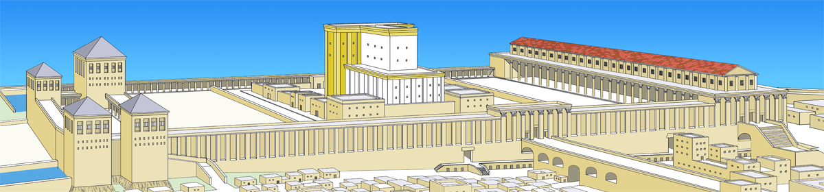
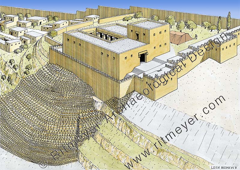
After David became king over Israel, he prepared a place for the Ark of the Covenant in Jerusalem. He pitched a tent, probably in the garden of his palace, until the Ark could be moved to the Temple that David’s son Solomon would build.
The record of their genealogy continues unto the time of Hezekiah who tried to undo the damage done to the Temple and its services by his father Ahaz. Hezekiah called for Levites to minister to God and to cleanse and consecrate the Temple. Among the Levites who responded to his summons was Shimri of the sons of Elizaphan with his brother Jeiel (2 Chronicles 29:13).
The next thing to find out is where did these Kohathites live? In Joshua 21:20,21 we read that they were given four cities out of the tribe of Ephraim, namely Shechem, a city of refuge, Gezer, Kibzaim and Beth-horon. According to the parallel passage in 1 Chronicles 6:68, Kibzaim is also called Jokmeam, identified with Tel el-Mazar[1] located in the central Jordan Valley.
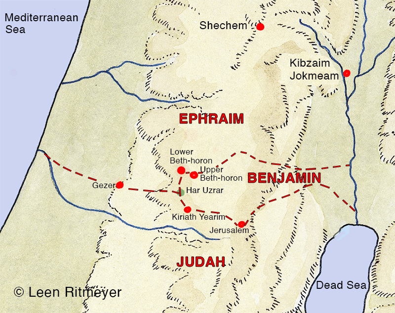
[1] Rainey, A.F. (2006). The Sacred Bridge, Jerusalem, p. 176.
The family of Elizaphan could of course have lived in any of these four cities. We need to ask the question which one of these four cities would have been the most advantageous for them to live in and conduct their official duties in the Jerusalem Temple?
It would be helpful to calculate the distances of these four cities from Jerusalem. Shechem is located at 60km (37 miles) from Jerusalem, Gezer at 36 km (22 miles), Kibzaim/Jokmeam at 62 km (38 miles) and Upper and lower Beth-horon at 16-18 km (10-12 miles).
Beth-horon was therefore closest to Jerusalem. As the sons of Elizaphan served in the Jerusalem Temple and they were leaders of the Kohathites, it would not be unreasonable to suggest that they would have chosen to live in Beth-horon. There were two places that were called Beth-horon, Upper Beth-horon and Lower Beth-horon, identified respectively by their Arabic names of Beit Ur el-Foqa and Beit Ur et-Tahta. This identification has never been challenged. The distance between these twin cities is 2.5 km (1.5 miles).
Both cities are situated high on the main road from Joppa (Jaffa or Yaffo) to Jerusalem and then continued to Jericho, and crossing over to Rabbath-Ammon. There are references to the “ascent of Beth-horon” and the “going down of Beth-horon”, depending in which direction one travels. Many armies have used this route, either to conquer places in the central mountain range, or fleeing back to where they came from after defeat. The Amorites fled down this road after their defeat in the Battle of Gibeon (Joshua 10:10-11), Philistine raiders assaulted Beth-horon from Michmash (1 Samuel 13:18) and in the Maccabean period battles between the Syrians and the Maccabees took place here (1 Maccabees 3:16,24; 7:39).
Since 1948, the main road from the west going up to Jerusalem runs through Bab el-Wad, but in biblical times, the western gateway to Jerusalem was the Beth-horon Road. In the 1980’s, a new road was built, Route 443, which follows the ancient Beth-horon Road. In biblical times, both Beth-horons and the road on which they were located, played an important role in the security of Judah and facilitated commerce.
Interestingly, on the 14th of July 2026, a Joint Announcement from the Prime Minister of Israel, Benjamin Netanyahu and Transportation and Road Safety Minister Brig.-Gen. (Res.) Miri Regev, said that the government has approved the proposal that the part of Route 443 between the Ben Shemen Interchange and the Beituniya-Givat Ze’ev Junction will be named “The Levites’ Way” to commemorate the name of David Levy[1]. It was also determined that the road will be given this name “in recognition of the historical and heritage connection of the region to the Tribe of Levi and the priests …”
It was pleasing to see that the present government of Israel is aware of the Levitical connection with this road. According to our research, the descendants of Elizaphan would have used this road to travel to the Temple in Jerusalem and back home again.
[1] The late David Levy served as Deputy Prime Minister, Minister of Foreign Affairs, Construction and Housing Minister, Aliyah and Integration Minister, and as a Member of Knesset for decades, and worked to promote social equality, strengthen the periphery, and narrow gaps in Israeli society. He was very popular with Sephardi Jews who shouted “David King of Israel” when elections for a new prime minister were held in Israel. He was deputy prime minister at various times between 1981 and 2000.
“Joint Announcement from the PM and the Transportation Minister
TYpe: Media Statements Government: The 37th Government Publish Date: 14.07.2026
The Government has approved the proposal of the Prime Minister and the Transportation Minister: Route 443 will be named “The Levites’ Way in Memory of Minister David Levy, of blessed memory”
The Government approved today, the proposal of Prime Minister Benjamin Netanyahu and Transportation and Road Safety Minister Brig.-Gen. (Res.) Miri Regev, to name Route 443 ‘The Levites’ Way’ in memory of Minister David Levy, of blessed memory, along the section of the road between the Ben Shemen Interchange and the Beituniya-Givat Ze’ev Junction.
This decision commemorates the legacy and long-standing achievements of the late David Levy, who served as Deputy Prime Minister, Minister of Foreign Affairs, Construction and Housing Minister, Aliyah and Integration Minister, and as a Member of Knesset for decades, and worked to promote social equality, strengthen the periphery, and narrow gaps in Israeli society.
In addition to commemorating the name of David Levy, it was determined that the road will also be called ‘The Levites’ Way’ in recognition of the historical and heritage connection of the region to the Tribe of Levi and the priests, as well as to the Modi’in area, which is identified with the Hasmonean family.
Route 443 is one of the most central and important transportation arteries in the State of Israel, connecting Jerusalem, Modi’in, Judea and Samaria, the Judean foothills and the center of the country, which is used daily by hundreds of thousands of drivers.
In accordance with the Government’s decision, the Ministry of Transportation and Road Safety, in cooperation with the Ministry of Defense, will work to update the signage along the road, and the Government Secretariat will act to publish the new name in the official gazette.
Prime Minister Benjamin Netanyahu:
“The late David Levy was a dedicated public servant who contributed immensely to the State of Israel. From his childhood in Beit She’an, he broke barriers and reached the leadership of the nation, where he championed social action and assistance for disadvantaged populations, while promoting peripheral towns. He was a loyal representative of the State of Israel and stood our ground proudly before the nations of the world. We are proud today to commemorate his memory on a road that connects our capital, Jerusalem, with the center of the country, as a symbol of a man who dedicated his life and energy to the unity of Israel.”
Transportation and Road Safety Minister Brig.-Gen. (Res.) Miri Regev:
“The late David Levy was one of the most prominent leaders of the State of Israel, who worked throughout his life for the unity of the nation, the promotion of the periphery, and social justice. Naming one of the central transportation arteries in Israel after him is a fitting tribute to a man who dedicated his life to the service of the state and Israeli society, ensuring that his legacy will continue to guide future generations.”
Both Beth-horons are located on the southern border of the tribal territory of Ephraim which is identical to the northern boundary of Benjamin from the River Jordan to Ataroth-adar, next to the hill that is located on the south side of Lower Beth-horon. From there the border turns south and joins Kiriyat-baal which is Kiryat Ye’arim (Joshua 18:13,14). This western part originally joined the eastern border of Dan, but they forsook their allotted portion and moved north to Laish/Leshem in modern day Tel Dan. The northern portion of Dan must have been taken over by Ephraim and the southern portion by Judah. This is reflected in the change of name from Kiriyat-baal to Baale Judah (2 Samuel 6:2). Interestingly, this location of the hill near Ataroth-adar also joined the territory of Ephraim (Joshua 16:5). So, here we have a hill south of Lower Beth-horon that is joined by three tribes, Ephraim, Benjamin and Judah. Lower Beth-horon overlooked the valley to the south toward Kiriyat Yearim (see map above).
Next time we will look at the meaning and importance of the name Beth-horon.