Recommended: The Historical Geography of the Holy Land

Before proceeding further with Recommendations from our Library, a giant of a book looms in our path. This is George Adam Smith’s: “The Historical Geography of the Holy Land.” It is not a large book in the physical sense, (or expensive), like our first recommendation: “The Sacred Bridge.” The greatness of this little book (first published in 1894), lies in the genius of its author to evoke the Land with his word-painting. He had a poet’s ear and words were his music. They came tumbling from his pen like streams. His ability to delineate the Land with all its sounds and scents and to people it in imagination with its successive historical inhabitants has never been surpassed.

Lovers of the Land today have a vast array of resources which make it possible to transport themselves there in imagination. There are CD ROMs, videos and satellite atlases. But, could any flyover give you that feeling of exactness you get when reading Smith’s Historical Geography (p.81): “There is the perspective of the Jordan Valley as you look up from over Jericho, between the bare ranges of Gilead and Ephraim, with the winding ribbon of the river’s jungle and the top of Hermon, a white cloud in the infinite distance. There is Gilead, where you ride, 2000 feet high, under the boughs of trees creaking and rustling in the wind, with Western Palestine before you. There is the moonlight view out of the bush on the north flank of Tabor, the leap of the sun over the edge of Bashan, summer morning in the Shephelah and sunset over the Mediterranean, when you see it from the gate of the ruins on Samaria down the glistening Vale of Barley?”

George Adam Smith, a Scottish Old Testament scholar, made four visits to the Land between 1880 and 1904, before the great changes which were wrought on the country by European colonists and Jewish immigrants. His intention in writing a Historical Geography was to: “give a vision of the Land as a whole” and to “help you to hear through it the sound of running history.” He certainly succeeded in meeting these aims. Some of our Israeli colleagues had memorised whole chunks of HGHL (as it was affectionately called)! Our much-missed friend and colleague, Yizhar Hirschfeld, once delighted us with a rendition of Smith’s description of Tel Gezer: “: “Shade of King Horam , what hosts of men have fallen round that citadel of yours! On what camps and columns has it looked down through the centuries, since first you saw the strange Hebrews burst with the sunrise across the hills, and chase your countrymen down Aijalon – that day when the victors felt the very sun conspire with them to achieve the unexampled length of battle. Within sight of every Egyptian and Assyrian invasion of the land, Gezer has also seen Alexander pass by, the legions of Rome in unusual flight, the armies of the Cross struggle, waver and give way, Napoleon come and go, and British yeomen come and stay. If all could rise who have fallen around its base – Ethiopians, Hebrews, Assyrians, Arabs, Turcomans, Greeks, Romans, Celts, Saxons, Mongols and English – what a rehearsal of the Judgement Day it would be!” (p.154).

But we treasure this work, not just for Smith’s unforgettable prose, but also for his erudition. His depiction is bolstered by reading that embraces the entire culture of the Middle East, much of it absorbed in the original languages. He quotes Hebrew, Arabic, Latin, Greek, French and German sources with the same facility as he does English. Herodotus steps out with the general to whom Napoleon dictated his memoirs of the campaigns in Egypt and Syria. Nasir-i-Khusrau is in there with Gertrude Bell and even some of his own Bedouin guides are quoted. But most of all it is the Hebrew Scriptures that he mines for his review of the various invasions the Land has undergone because, as he writes: “to these the pages of prophecy are as sensitive as the reedbeds of Syria to the passage of the wind and the flood” (p. 35).

It is as a preacher and teacher that he was best known. However, one of his travel companions observed that he would have made a great general, as he had both the natural gift of leadership and the commander’s eye for country. Another great general, General Allenby, consulted Smith’s Historical Geography daily (together with his Bible), using it as a kind of military handbook in the Palestine campaign of 1917/18. Indeed, the German-Turkish army was defeated by a surprise British attack in Michmash in a replay of Jonathan’s rout of the Philistines in the same place recorded in 1 Samuel 14. Both Jonathan, with his armour-bearer and the British force had to creep up the same gorge, the Wadi Suweinit, with the rocky outcrops known as Bozez and Seneh on either side, in order to reach the enemy camp. Another boon for the British Army was the fact that when their stores of water ran dry in that parched land, they were able, through studying HGHL and its original maps, to rediscover many wells whose location had vanished from local memory.

The Historical Geography of the Holy Land is a classic, not in the sense of a respected book gathering dust on a bookshelf, but as a trusty tool of the trade, stuffed into the pocket of every serious explorer of the Land from his time and since. And if you cannot make the journey, just open the book, with an atlas by your side. Every page is a picture-frame, capturing the essence of and deeply enriching our experience of that “glory of all lands.”

All quotes from The Historical Geography of the Holy Land are from our yellowed and watermarked 1966 Fontana Library Edition, Third Impression, 1973.

Recommended: The Sacred Bridge

We promised to review books that will stand the test of time. One of the books we treasure most (and which we would never dream of lending out, for fear of being left without it!) is The Sacred Bridge by Anson Rainey and Steven Notley. Reading it is like visiting a library with an erudite companion, who knows all the languages necessary to explore the culture in which you are interested or like walking in Bible lands with an omniscient voice guiding you: “This is the way, walk ye in it!”

The culmination of the life’s work of Anson Rainey, probably the world’s greatest authority on Semitic languages, together with Steven Notley, a notable New Testament scholar, this book contains learning more typical of nineteenth century scholarship, coupled with twenty first century presentation. Its prototype was the seminal Macmillan Bible Atlas, by Aharoni and Avi-Yonah, first brought out by Jerusalem’s Carta publishers in 1968 and which covered numerous aspects of the Biblical period.

The premise of this latest title is set forth in the blurb: “The Land of Canaan, the Land of Israel and early Roman Judea are treated as the southern part of the Levant, and as the focus in Ancient Near Eastern and Mediterranean history. The Levant is the land bridge between Asia and Africa, between Greco-Roman culture and the coasts of Arabia. As such it has seen the influx of peoples bringing new blood and initiatives to the life of the region. It has also suffered the conquerors’ heel as ancient empires sought to dominate this geographical hub of communications and commerce. The historical experience of the southern Levant, well documented in the Bible and in many inscriptions from Egypt, Mesopotamia, Syria and Anatolia, has become enshrined in Jewish/Christian tradition … It is therefore more than a land bridge between different cultures. It is a bridge of faith.”

The Sacred Bridge‘s main distinguishing feature is that it utilises the languages of the written sources to cast light on the Bible and its geography. Biblical texts are considered side by side with the other ancient Near Eastern sources, Egyptian, Akkadian, West Semitic and Greek. The use of colour coding makes a book with so many academic features more accessible. References are printed in red, original texts in light blue, with their translation in dark blue. It is very moving to read Lachish Letter No. 4, which bemoans the fact that the fire signals of Azekah, the only other fort remaining in Judah against Nebuchadnezzar’s campaign could no longer be seen from Lachish, in the original. There are very few books in the popular domain in which this is possible.

Produced by Israel’s best-known cartographic publishers, its maps, needless to say, are excellent and we have used them extensively in our work for a new digital Bible. On numerous occasions while mapping journeys, we were struck by the inevitability that Biblical characters chose to go by a certain route because of historic connections. An example of this would be the fact that both King David and Jesus crossed over the Brook Kidron after their betrayal. With the help of this magisterial volume, you too will be able to “pass through” Bible lands, as did the Hebrews (whose name literally means “passer through”), and absorb the lessons embedded in these singular places.

Lost in words – Recommendations from our library

Libraries have transformed our lives. Living in Jerusalem, as we did for many years, we had access to some of the world’s greatest libraries. The Hebrew University had the largest collection of works on Jewish culture (many donated by supporters of the fledgling State of Israel). Sadly, some of these precious volumes were vandalised by students, with many of the books’ spines broken due to photocopying or even missing pages! Our professor, Benjamin Mazar, also had a prodigious book collection at his home in Rehavia, which he shared very generously with us. It was the library of the École biblique et archéologique française, however, that blew our bibliophile’s socks off. Here, such solicitous care was taken of the library’s 140,000 volumes, that a “fantôme”, or mock volume had to replace every book that was removed, until said book was returned to safety.

The more we read, the more the city of Jerusalem and the Land of Israel stepped out of the shadows and into our comprehension. We were cool university students no longer, when we perhaps did not appreciate the richness of the Library of the Academy in Arnhem or Dublin’s splendidly domed National Library. We hungered to understand the lessons that the past of our adopted country could teach us.

Reading Jerusalem Revealed, when it came out in 1975, was an epiphany, making sense of the results of the explosion of excavations that had become possible after the 6-Day War. We carried single volumes of Josephus around in our pockets, seeking his contemporary witness to the ancient city we were trying to build up in our minds. We scrutinised the tractates of the Mishnah, some of which were written by rabbis who had observed the ritual of the Temple prior to its destruction in 70 A.D. Each book stood out like a milestone and we felt that we were becoming the sum of the books we had read. We must remember that because of the unprecedented opportunities in archaeology at that time, there was a flowering of works reporting on the dramatic new discoveries. Kathleen remembers comparing the books that were appearing then, with the single book, Kenyon’s Archaeology in the Holy Land, that was recommended for her course on this subject in University College Dublin in the early 70’s!

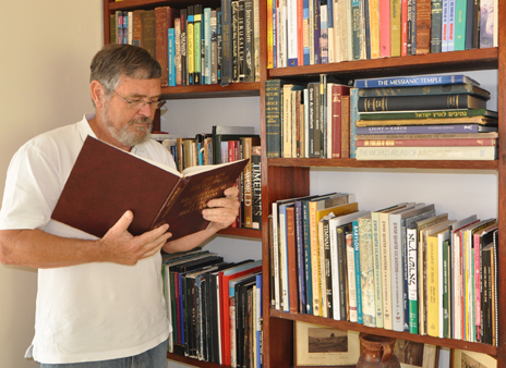
Now we live in Cardiff, Wales, far from the enticements of the Bodleian and British Libraries. However, due to our drawings being printed in numerous publications and the requests for book reviews we receive, we have managed to amass our own extensive private library. We can truly say that our books transport us every day to the Land, allowing us to live a life unfettered by sea or border crossings. In our book-lined space, we can explore Jerusalem’s Gihon Spring, walk around the destroyed city walls with Nehemiah or bring in our boat to harbour in first century Capernaum – all without leaving our chair.

Despite the dominance of Google, we are often asked to recommend books to our readers. For that reason, we hope to regularly post reviews of publications (and occasionally movies or software) we consider useful, defining and illuminating. Look under the Recommended menu for reviews of works that will stand the test of time!