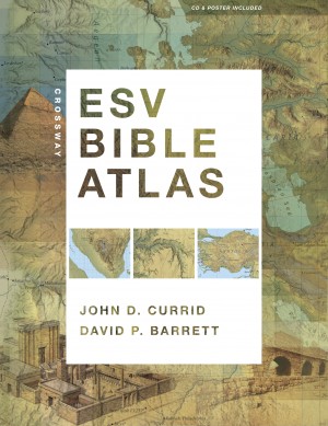
A few months ago, we received a pre-press copy of the ESV Bible Atlas to review:

Already then, we were very impressed with this atlas and wrote the following endorsement:
“I had the privilege of being involved in the production of drawings based on the latest research for the ESV Study Bible. It is a joy to see these drawings plus the original ESV Study Bible maps, woven together with numerous new maps, brilliantly evocative photographs and useful indexes to make up the new Crossway Bible Atlas. This volume will become an indispensable companion for Bible students, fulfilling every expectation you might have of such a tool. Particularly innovative is the use of terrain imagery to facilitate the reader’s understanding of such Biblical viewpoints as that of Abraham from Hebron over the cities of the plain or Moses from Mt. Nebo.”
Justin Taylor, who was the managing editor of the ESV Study Bible, wrote this in his blog:
“One of the neat things for me is being able to see the ESVSB illustrations—of the tabernacle, the temples, Jerusalem at various times, etc—in great detail over a two-page spread on glossy paper.”
We agree that on this glossy paper, the reconstruction drawings look even better than in the Study Bible. We are further told that
The new Crossway ESV Bible Atlas (352 pages) will be shipping soon from Amazon.
The text of the Atlas was written by Professor John Currid (RTS-Charlotte, NC). The maps were done by David Barrett, who also served as the cartographer for the ESV Study Bible. Here’s what it contains:
175 full-color maps
70 full-color photographs
3-D re-creations of biblical objects and sites
indexes
timelines
65,000 words of narrative description.
“The atlas uniquely features regional maps detailing biblically significant areas such as Egypt, Mesopotamia, Italy, and Greece. It also includes a CD with searchable indexes and digital maps, and a removable, 16.5 x 22-inch map of Palestine.”
You can flip through some of its pages here
As he lives in the USA, Todd Bolen received his copy yesterday, we can’t wait to receive ours in the UK soon as well.

I just received my [discounted] copy of the ESV BIBLE ATLAS from AMAZON and it is very well done. The maps/illustrations are in-depth and elegant. There is a small, removable map poster of the land of “Palestine” in the back … and a CD with hyper-linked map images from a simple timeline html file. Pretty nifty. All-in-all a great investment. Should wear it out in the coming years. Thanks for your advisory/contributions Leen … the Temple/Mount images and the gradual illustrations of Jerusalem’s morphing-through-the-centuries are very well done and much appreciated due to their realism and accuracy. Great stuff.
Thanks Daniel,
The atlas sounds great, but I am still waiting for my copy!