Today the Israel Antiquities Authority announced:
A fascinating discovery recently uncovered in archaeological excavations the Israel Antiquities Authority is conducting in the Givati parking lot at the City of David, in the Jerusalem Walls National Park, has apparently led to solving one of Jerusalem’s greatest archaeological mysteries: the question of the location of the Greek (Seleucid) Acra–the famous stronghold built by Antiochus IV in order to control Jerusalem and monitor activity in the Temple which was eventually liberated by the Hasmoneans from Greek rule.
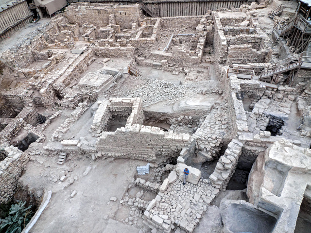
It is true that the location of the Seleucid Akra has baffled archaeologists for a long time. In 2006 I wrote:
Among scholars, there is less disagreement about the historical interpretation of the Books of Maccabees and Josephus than about the topographical problems connected with the location of the Seleucid Akra, which are styled the “most debated,” “most enigmatic and “thorniest” by Simons, Avigad and Wightman, respectively.
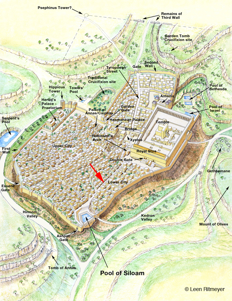
But could the Akra have been located so far away from the Temple Mount? Both the Book of Maccabees, as well as the historian Josephus Flavius, locate the Acra in the lower city of Jerusalem:
“And they built the city of David with a great and strong wall, and with strong towers, and made it a fortress [Greek: Acra] for them: And they placed there a sinful nation, wicked men, and they fortified themselves therein” — 1 Maccabees 1:35–38
“…and when he had overthrown the city walls, he built a citadel [Greek: Acra] in the lower part of the city, for the place was high, and overlooked the temple; on which account he fortified it with high walls and towers, and put into it a garrison of Macedonians.” — Flavius Josephus, Antiquities of the Jews 12:252–253
The quote from 1 Maccabees tells us that the whole of the City of David was fortified with a wall. The Hellenistic walls found here may indeed be part of these fortifications. Josephus, however, is speaking of a separate citadel – the Seleucid Akra. This fortress we are told “overlooked the temple”. In order for the Givati remains to belong to this citadel and also overlook the Temple, it must have been over 400 feet high at least.
Once the Akra was destroyed by the Maccabees, the whole area was leveled and added to the Temple Mount. Following that, 1 Maccabees 13.52 and 14.37 tell us that,
“He strengthened the fortifications of the Temple Mount by the side of the Akra, and took up residence there with his men.… He settled Jewish soldiers in it and fortified it as a protection for the country and city, and heightened the walls of Jerusalem.”
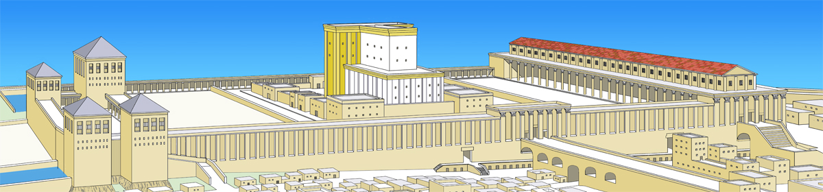
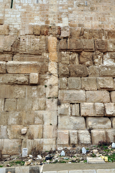
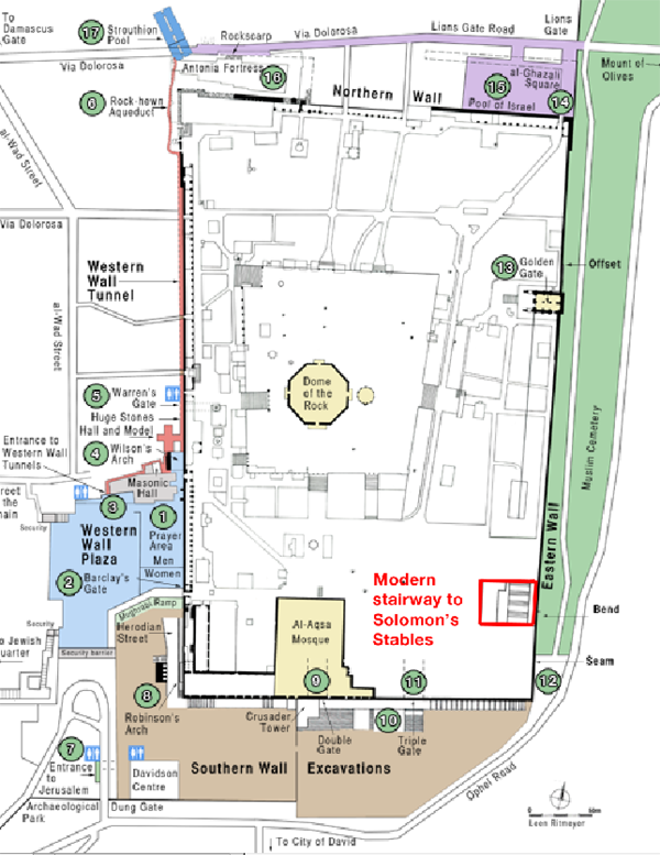
This appears to indicate that a large area, previously occupied by the Akra, was built adjacent to the Temple Mount. This extension can still be seen at the “seam” in the Eastern Wall of the Temple Mount.
The fact that the Akra previously overlooked the Temple Mount means that the Temple Mount could be overlooked by someone standing on the highest parts of this fortress. The fact that the southeast hill slopes away rapidly in all directions to the south of the square Temple Mount excludes all but the highest rock levels near the southern wall of the square Temple Mount as the only possible location for the Akra.
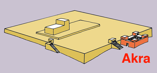
One of the cisterns in the southern part of the Temple Mount – Cistern 11 – was known as the Cistern of the Akra (Mishnah Erubin 10.14). Josephus also writes that after Simon the Maccabee had razed the Akra, “thought it would be an excellent thing and to his advantage to level also the hill on which the Akra stood, in order that the Temple might be higher than this” (Ant. 13.215).

The Seleucid Akra therefore stood on a hill very close to the Temple Mount. What hill is there to be seen in the Givati parking lot? It appears therefore that the Israel Antiquities Authority once again tries to make sensational headlines with an unworkable theory in order to get some publicity.




 He contacted me a while ago regarding illustrations for the original Russian publication by