Yisrael Medad reported yesterday that renovation work is again being carried out inside the Dome of the Rock and that scaffolding has been put on The Rock, known as the Foundation Stone.
He rightly complains that none of the Israel State authorities have shown any inclination to commit themselves to the Protection of Holy Places Law:
The Holy Places shall be protected from desecration and any other violation and from anything likely to violate the freedom of access of the members of the different religions to the places sacred to them or their feelings with regard to those places…2 (a) Whosoever desecrates or otherwise violates a Holy Place shall be liable to imprisonment for a term of seven years.
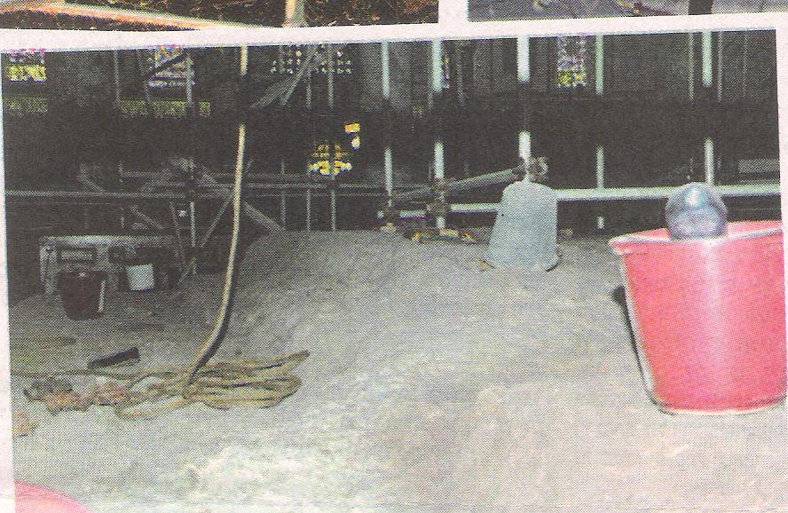
His article was accompanied by these pictures, which were scanned from the Makor Rishon newspapaer:
Pails, ropes, the bottom rungs of a construction workers' support platform and other items required for the renovation of a building were placed on The Rock.The Dome of the Rock is being renewed and no one from amongst Israel's Chief Rabbinate nor any archaeological supervisory institution was asked to either agree, oversee or lend an opinion.
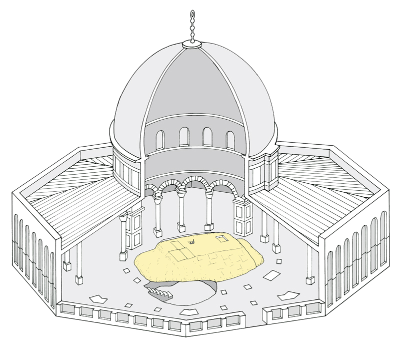
The Rock, known in Arabic as the Sakhra, around which the Dome of the Rock was built, was of course the location of the Holy of Holies of the Jewish Temple in Jerusalem. This drawing shows the location of The Rock inside the Dome of the Rock:
The plan shows the relationship between The Rock and Solomon’s Temple:
This plan shows The Rock, which is the top of Mount Moriah, (now inside the Islamic Dome of the Rock), where Abraham was sent to sacrifice his son Isaac (Genesis 22.2). The Holy of Holies (Most Holy Place) of Solomon's Temple stood on this mountain top. The walls of Solomon's Temple are indicated in blue. When Solomon built the Temple, it was necessary to create flat areas in order for the rectangular foundation stones to stand perfectly horizontal. The foundation trench of the southern wall of Solomon's temple can still be detected. The western and northern walls were built against rock scarps. In the centre of the Holy of Holies is a level depression that was specially made for the Ark of the Covenant (1 Kings 8.6,21). After the destruction of the First Temple in 486 BC, the Second Temple was built in the same location.
Medad’s article is followed up by Nadav Shragai’s blog post “The Temple Mount: Second Temple-era mikveh discovered under Al-Aqsa mosque”. This, of course, is not a recent find, as it was already discovered in the 1930’s by Hamilton, although made public only a few years ago. See these previous posts here and here.
Nadav’s post is, however, worth reading as it gives a potted history of what happened on the Temple Mount since the devastating earthquake in 1927.
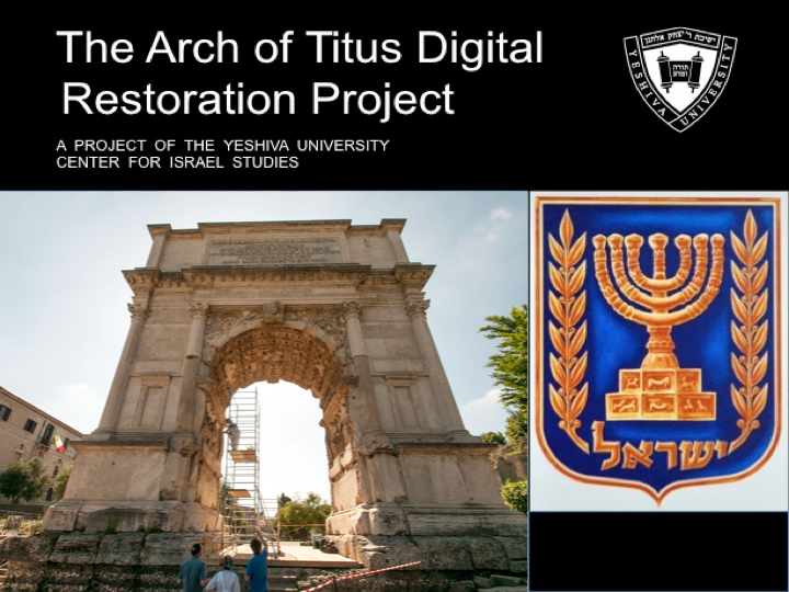
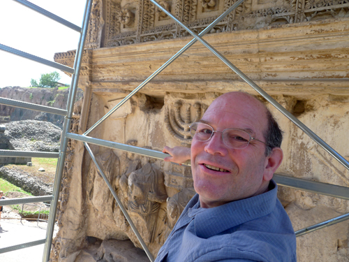
Dr. Steven Fine of the Yeshiva University Center for Israel Studies in New York is heading The Arch of Titus Digital Restoration Project in Rome, which has as its aim the scanning of the menorah panel for evidence of ancient color.
Today the results were announced:
From June 5 to 7, 2012 an international team of scholars led by the Yeshiva University Center for Israel Studies in partnership with the Soprintendenza Speciale per i Beni Archeologici di Roma undertook a pilot study of the Arch of Titus in the Roman Forum, the ancient civic center of Rome, Italy. The focus of attention was the Menorah panel and the relief showing the deification of Titus at the apex of the arch.
The arch was originally dedicated after the Emperor Titus’ death in 81 CE and celebrates his victory in the Jewish War of 66-74 CE, which climaxed with the destruction of Jerusalem and her Temple in the summer of 70 CE.
The arch has three bas reliefs. One shows the deification of Titus. Two other reliefs depict the triumphal procession held in Rome in 71 CE: in one we see Roman soldiers carrying the spoils of war through the city, including the famous Menorah (the seven-branched candelabrum) and other treasures of the destroyed Temple. These were put on display in Rome in the Temple of Peace not far from the arch. The second panel shows Titus riding in triumph through the city.
High resolution three-dimensional scans of the Menorah and the deification reliefs were made, and part of the Menorah relief was examined to determine whether any traces of paint decoration were preserved. A Breuckmann GmbH 3D scanner was used for the data capture. UV-VIS spectrometry was employed to detect color on the marble reliefs.
The pilot project was a complete success. The scan data were processed to create a 3D representation of the form of the reliefs with sub-millimeter accuracy. Traces of yellow ochre were found on the arms and base of the Menorah. This discovery is consistent with biblical, early Christian, and Talmudic writings and particularly eye-witness descriptions of the golden menorah by the first century historian Josephus.
In the next phase, the team plans to expand the search for ancient paint over the entire surface of the arch, which will also be scanned in 3D. The data collected will enable the Yeshiva University team to create a three-dimensional digital model of how the arch originally appeared, including the colors decorating its surface. The model will be added to Rome Reborn, a 3D digital model of the entire city of Rome at the peak of its development.
Dr. Fine on Site in Rome
It is interesting to note that polychromy is becoming a new focus in Jewish Studies. Usually synagogues and ancient buildings are shown in white, but originally much more color was used in the decoration of buildings than we would expect.
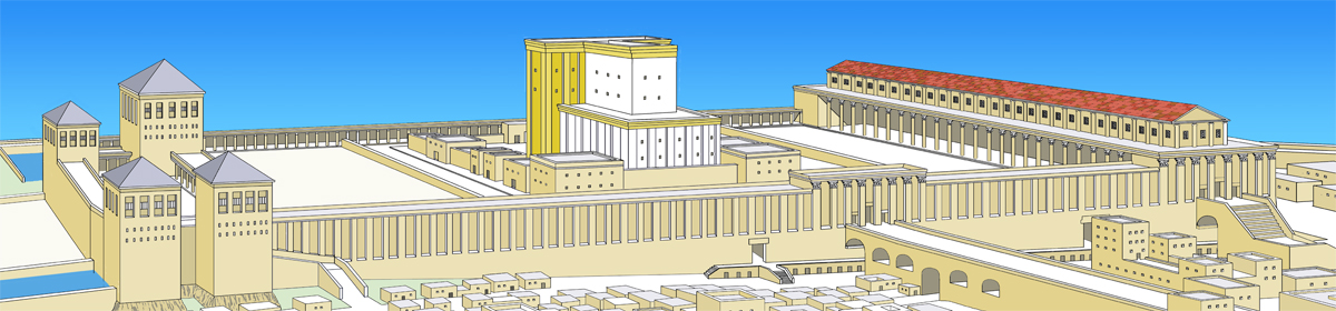
In the case of the Jerusalem Temple, it is often portrayed as a building with a white facade, but Josephus called Herod’s Temple “a structure more note-worthy than any under the sun” (Ant. 15.412) and in War 5.207–226 he gives a glowing description of the Temple (The Quest, p. 373):
The sacred edifice itself, the holy Temple, in the central position, was approached by a flight of twelve steps. The façade was of equal height and breadth, each being a hundred cubits; but the building behind was narrower…. The exterior of the building wanted nothing that could as- tound either mind or eye. For, being covered on all sides with massive plates of gold, the sun was no sooner up than it radiated so fiery a flash that persons straining to look at it were compelled to avert their eyes, as from the solar rays. To approaching strangers it appeared from a distance like a snow-clad mountain; for all that was not overlaid with gold was of the purest white. From its sum- mit protruded sharp golden spikes to prevent birds from settling upon them and polluting the roof.
The traces of yellow ochre that were found on the arms and base of the Menorah may support Josephus’ description of Herod’s Temple in Jerusalem.
The Israel Antiquities Authority reports that in archaeological work it is conducting in the 2,000 year old drainage channel between the City of David and the Jerusalem Archaeological Garden:
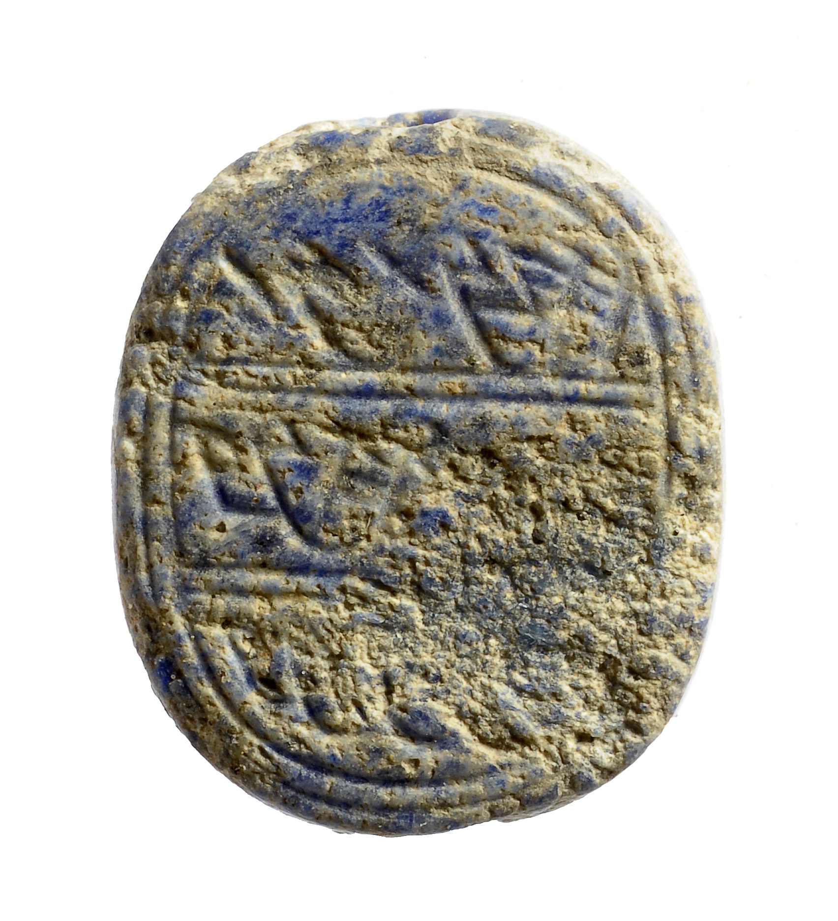
Remains were Discovered of the Closest Building to the First Temple Exposed so Far in Archaeological Excavations, and on its Floor – a Hebrew Seal Bearing the Name ‘Matanyahu’
People used personal seals in the First Temple period for the purpose of signing letters and they were set in a signet ring. The seals served to identify their owner, just as they identify officials today.
According to Eli Shukron, excavation director on behalf of the Israel Antiquities Authority, “the name Matanyahu, like the name Netanyahu, means giving to God. These names are mentioned several times in the Bible. They are typical of the names in the Kingdom of Judah in latter part of the First Temple period – from the end of the eighth century BCE until the destruction of the Temple in 586 BCE. To find a seal from the First Temple period at the foot of the Temple Mount walls is rare and very exciting. This is a tangible greeting of sorts from a man named Matanyahu who lived here more than 2,700 years ago. We also found pottery sherds characteristic of the period on the floor in the ancient building beneath the base of the drainage channel, as well as stone collapse and evidence of a fire”.
In a previous illustrated post I reported on walking through this drainage channel. The finding of a seal within building remains is exciting news.
In another post, I published this plan of the drainage channel near the southwest corner of the Temple Mount:
Plan of the drains at the southwest corner, as discovered by Warren, and their relationship to the square Temple Mount and the subsequent extensions. From: The Quest, Revealing the Temple Mount in Jerusalem, p. 234.
This plan shows that the drain cut through two tombs, which, according to the late Prof. Benjamin Mazar, belong to the Iron Age, as both have a ‘nefesh’ hole in the ceiling. There are several other tombs in this area with a similar design, one of which was converted into a mikveh in the Hellenistic period. These tombs are evidently part of a cemetery from the Iron Age.
As tombs are usually found outside the city walls (apart from the tombs of the kings), they probably date from before the time of King Hezekiah, who was the first king to include this area within his expanded city, when he built a wall round the Western Hill of Jerusalem. The building remains probably date to a time when pressure of space turned this location into a residential area, which could only have happened from the time of Hezekiah and onward.
The Friends of the Israel Antiquities Authority announced that
the William Davidson Foundation recently approved a very generous grant for the establishment of the East Hall Exhibition and Education Gallery in the Ethan and Marla Davidson Center for Exhibitions and Virtual Reconstruction in the Jerusalem Archaeological Park. The Davidson Center, which was made possible by the generosity of William (Bill) Davidson and opened to the public in 2001, became an overnight success, and is visited by hundreds of thousands of people annually.
The new East Hall of the Davidson Center will be established in a ca. 4,000 sq. ft. room dating to the Umayyad period (7th Century CE), that served as a storage room in an Umayyad palace, and is similar to the rooms in which the Davidson Center is now located. It is a square room measuring 62 x 62 ft, surrounded by 7 foot wide walls, and is adjacent to the Davidson Center.
The transformation from what the area originally looked like during the Temple Mount Excavations is amazing:
Underground halls of Umayyad Building II, discovered in the Temple Mount Excavations led by the late Prof. Benjamin Mazar.
In the Umayyad period (c. 661-750), large palaces and administrative buildings were constructed to the west and south of the Temple Mount:
You can see several interesting archaeological videos on the website of The Friends of the IAA. By clicking on the picture below, you can see a virtual reconstruction of these Umayyad buildings around the Temple Mount:
The new exhibition will be housed in the underground halls of the building in the foreground
HEKHAL is the name of the newly formed Irish Society for the Study of the Ancient Near East. It was created by a group of four Trinity College Dublin graduates who wish to:
promote research in the fields of ancient near eastern history and historiography, biblical studies, and archaeology with the long-term aim of increasing both academic and public understanding of the biblical and ancient near eastern world and its texts.
On 25–27 May 2012, they will hold their first annual symposium in Dublin, called:
Among the twenty-four speakers there are three Israeli archaeologists, Yosef Garfinkel, Joseph Patrich and Mordechai Aviam.
My talk is entitled “Relating the Temple Scroll from Qumran to the architecture of the Temple Mount in Jerusalem” and is scheduled for Sunday, 27 May, from 9.00 – 10.00 am.
Yesterday we reported on an article about “Roman Jerusalem”. In today’s Jerusalem Post, there is a similar article, this time about Jerusalem of the time of Jesus.
This well illustrated article describes the remains of several Herodian villas which were excavated by the late Prof. Nahman Avigad and subsequently restored and opened to the public. It has been suggested that the largest villa, called the Palatial Mansion, may have been the residence of the High Priest at that time.
While studying Conservation at the Institute of Advanced Architectural Studies at the University of York, archaeologists of the York Archaeological Trust showed us graphs indicating that the number of visitors coming to York during the month of February was always the lowest. That is why they organize the Jorvik Viking Festival every year, which includes the burning of a Viking boat on the river (incidentally, the website has a page on Barley Hall, the restoration of which I was fortunate to have been involved with).
This general trend is well-known in commerce and tourism, hence the protracted sales and low prices to attract customers during February. That may have been the reason why Haaretz put up an article on Roman Jerusalem, then called Aelia Capitolina, which is well written and interesting, but contains nothing new.
The fact that the straight streets, such as Chabad and Hagai, David Streets and the Via Dolorosa, date back to the Roman period has been known for a long time. Both the Cardo Maximus and the Lower Cardo began at the Damascus Gate in the north of the city, as shown on the Madaba Map.
The very interesting excavation to the west of the Western Wall Plaza, where a good stretch of the Lower Cardo was found, has been well documented previously and the street was known long ago from the Madaba Map. The discovery of a Roman Bath house has also been reported earlier, as was a Roman building in the Givati parking lot.
Experts agree the city was planned extraordinarily well, based as it was on designs of other cities in the empire and according to orders that came directly from the emperor.
To be sure, some new evidence has come to light during the last decade, but nothing revolutionary or earthshaking that was not known many years ago.
Avigad would be pleased! Yesterday we received Vols. IV and V of the final reports of the Jewish Quarter Excavations in the Old City of Jerusalem, Conducted by Nahman Avigad 1969-1982. The first four volumes were edited by Hillel Geva and the fifth by Oren Gutfield. More volumes are in preparation.
This web page contains descriptions and downloadable PDF flyers, with pictures of the book covers, contents and order forms.
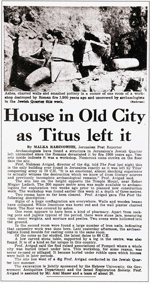
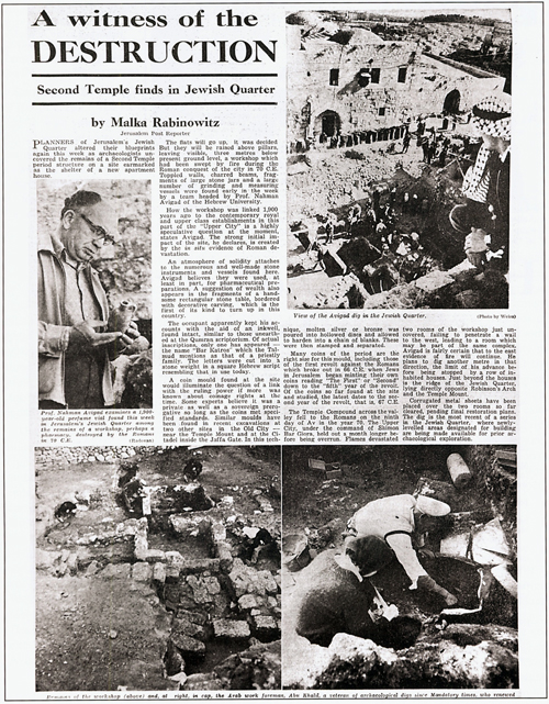
It was a mammoth task to prepare these volumes and Hillel and Oren are to be commended for their dedication and hard work to publish the results of these unique excavations. I can’t resist sharing these newspaper reports of when the Burnt House was first discovered and that were reproduced in Volume IV.
The Jerusalem Post, 16 Jan. 1970
Jerusalem Post, 23 January 1970
I remember Avigad telling me that during the excavation of the Burnt House, people were standing 4-deep around the area being dug, especially after the finding of a girl’s skeletal arm, the nation of Israel was so electrified.
After working on the Temple Mount Excavations, I began working on the Jewish Quarter Excavations, beginning in 1978. It was a very memorable privilege to have been able to draw up most of the plans for the Burnt House and other areas which were excavated in the quarter, which had been severely damaged by the Jordanians. Working for Avigad wasn’t restricted to my architectural contributions. When the Burnt House was eventually opened to the public, I was honored, to be the only one, with Kathleen, to be entrusted with the care of cleaning the glass display cases of the precious finds from the site. On a number of evenings we had to get a baby sitter for our children so we could drive over the cobble stones of the Jewish Quarter and take our vacuum cleaner and dusters into the eerily silent Burnt House.
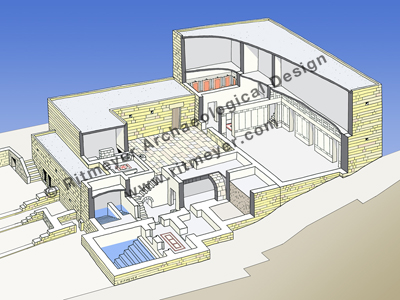
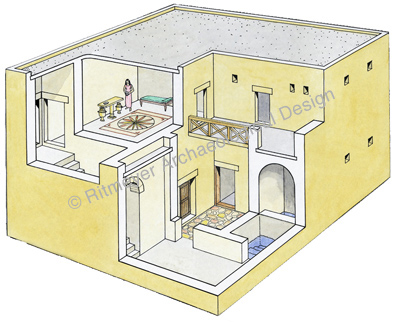
Eventually, I made this reconstruction drawing of Burnt House:
Reconstruction drawing of the Burnt House. Leen Ritmeyer
Apologies for not having blogged a while, but I was busy with projects. For those of you who had sad thoughts about my absence, these are unfounded, as this picture shows:
With apologies to L. Jongewaard
Received an invitation marking the 20th anniversary of the death of Prof. Nahman Avigad to be held on Wednesday February 15th, at the Ben-Zvi Institute, Rehavia, Jerusalem.
Working with Avigad on the restoration of the Cardo and the Herodian Villas in the Jewish Quarter of the Old City of Jerusalem, I developed a deep appreciation for him. He was a kind person, meticulous in his work and research and willing to share his profound knowledge of archaeology and ancient architecture.
Avigad (centre) with Leen (left) inspecting the stucco work of David Simon during the restoration of the Palatial Mansion
The evening will also mark the publication of the 5th Volume of the Jewish Quarter Excavation final report. This volume contains my contribution on “The Restoration of the Cardo” (chapter 3).
A few days ago, the Temple Mount Sifting Project published an article about a fiscal bulla (a lump of clay that bears the imprint of an inscribed seal) that was found in an excavation on the eastern slope of Mount Moriah:
The bulla carries an Ancient Hebrew inscription: “[g]b’n/lmlk“, i.e. “Gibeon, for the King”. The bulla originates from the eastern slope of the Temple Mount, descending into the Kidron Valley. The bulla belongs to a group of bullae which were called by N. Avigad “Fiscal Bullae”. Presently we know more than 50 bullae of this type. They comprise two groups, one with names of cities in the kingdom of Judah, and the other with names of royal officials.
The Gibeon bulla, showing the inscription on the left and the back of the bulla on the right. Photo: Zev RadovanThe inscription of the bulla, reconstruction by Gabriel Barkay.
These ‘lmlk’ (for the king) bullae sealed tax commodities sent to the King of Judah and date from the time of King Hezekiah. About 50 of these fiscal bullae are known, but this is the first one that came from an archaeological rescue excavation. Gabriel Barkay has published an extensive article (in Hebrew) in which he discusses the entire phenomenon of the fiscal bullae.
The bullae include names of 19 different cities of Judah, and dates of the reign of one of the Judean kings, usually in hieratic numerals, as well as the particle “lmlk“, “for the king”. The components of the inscriptions are discussed, as well as the geographical history of the bullae, and its comparison to the list of Judean cities in Joshua 15: 20-63. The fiscal bullae represent a taxation system from the different Judean cities, based on yearly taxes, which probably replaced the previous one, reflected in the royal Judean jars and their seal impressions, from the time of King Hezekiah.
Not all of the cities, however, are mentioned in Joshua 15. Two cities belonged to Simeon, Eltolad and Bethul, and Gath was a Philistine city during most of the Biblical period. Here is the list of the 19 cities and where they are mentioned first:
These originally were all Canaanite cities that were conquered by Joshua and were still part of the Kingdom of Judah during the reign of King Hezekiah.
The city of Gibeon, viewed from the south. Photo: Leen Ritmeyer
Gibeon did belong to a group of four Canaanite cities that made a covenant with Joshua by disguising themselves. After having been found out by Joshua, he made them hewers of wood and drawers of water for the house of God (Joshua 9).