I was recently interviewed by John Enarsson of “Cry for Zion” on Temple Mount issues and also on our new guide book to the Temple Mount, which we reported on in previous posts here and here. These are some of the questions that were asked:
1. Do we know beyond a reasonable doubt that the (1st and) 2nd Temple stood on the Temple Mount? Why? What would be the most important reasons?
2. Do we have good reason to believe that the Holy of Holies was centered on the Foundation Stone? Why? What is the feeling in the scholarly field on this question?
3. A few years ago, you debunked the sensationalistic theories of Ernest L. Martin. Today, the adventurer and author Robert Cornuke is making Martin’s ideas about the Temple popular again to a wider audience. Have you read Cornuke’s book TEMPLE and could you comment on it?
4. Josephus has long been a favorite source for archeologists. What role do traditional rabbinic sources like the Mishnah play for archeologists like yourself?
You can listen to the 30-minute audio podcast, which includes the interview, here:
“This was the most accurate and authentic reenactment of this service to have taken place in nearly 2,000 years.”
It included all the stages of the ritual, such as checking the animal for blemishes, slaughtering it, collecting its blood and bringing it to the corner of the altar, skinning the animal and separating its inner parts, and roasting it whole in a special Passover oven.
Breaking Israel News reports on an altar that has been built by the Temple Institute. You can read the report here.
The altar built by the Temple Institute to be used in service in the rebuilt Third Jewish Temple. (Photo: The Temple Institute)Priests carrying vessels near the Ramp of the Altar
According to this report, the Temple Institute in Jerusalem has completed the construction of the stone altar required for the sacrificial service in the Holy Temple. One thing that makes this altar unique is that it was designed to be disassembled and quickly reassembled in its correct position on the Temple Mount. According to the Temple Institute,
“The people of Israel are required to build an altar exclusively on the site of the original altar on Mount Moriah, the Temple Mount. When circumstances become favorable, this new altar can be quickly re-assembled on the proper location, enabling the Divine service to be resumed without delay.”
It was a little strange to see the red tiles and bricks, but they are supposed to be the outer layer only, while the inner part was built with natural stones.
A few years ago, the Temple Institute asked me for lectures regarding the layout of the Temple and the location of the Altar. They appear to agree with our plan as shown in our new Temple Mount guide book. In our book we show a plan of the altar in relation to the Dome of the Rock and also a photograph with its location:
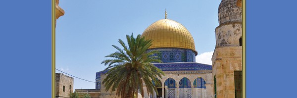
This plan shows Herod’s Temple, courts and Altar (beige) in relation to the Dome of the Rock and the Dome of the Chain (blue). The Rock inside the Dome of the Rock was the Foundation Stone of the First and Second Temples on which the Holy of Holies was built. The Dome of the Chain stands on the former Porch that was built in front of the magnificent Temple built by Herod and the great Altar of Burnt Sacrifices stood to its east.A view of the Dome of the Rock, looking west, with the Dome of the Chain to its east. The Altar stood in the open space between the Dome of the Chain and the steps that lead up to the Raised Platform from the east.
One wonders when and how the Temple Institute will be able to build this altar in its original location.
Todd Bolen of BiblePlaces was alerted by one of his friends, Austen Dutton, that the bridge of the skull’s nose had collapsed. You can read Todd’s interesting post here.
The Temple Mount Sifting Project reported a significant improvement of the enforcement and supervision of the Israeli Antiquities laws on the Temple Mount. The Old City and the Temple Mount are part of the archaeological zone, in which no excavations are allowed without archaeological supervision. As far as the Temple Mount is concerned however, this rule has been ignored for too long. Happily, the construction work that is taking place at the moment, digging shallow channels in the area just northwest of the Raised Platform, is being carried out under the supervision of the Israel Antiquities Authority.
Channels for new sewage pipes in the northern part of the Temple Mount. Photo: TMSP.
This is good news, as I believe that there are many archaeological remains still to be uncovered in the area under discussion and any fresh information may cast light on the historical development of the Temple Mount and the city of Jerusalem. We need to remember, of course, that this area became part of the Temple Mount for the first time only in the Herodian period. During the First Temple period, this area was located outside and north of the Temple Mount and the city of Jerusalem. The northern wall of the Temple Mount of that time was also part of the northern city wall of Jerusalem.
Charles Warren uncovered the most important archaeological remains in this area, namely the “Fosse” or “Moat” that separated the original square Temple Mount from the northern continuation of the Eastern Hill of Jerusalem. Although never excavated, the remains can clearly be seen in old photographs, taken from the Antonia Fortress.
View from the Antonia Fortress, indicating the location of the Fosse and the Herodian paving stones.
While working on the Temple Mount Excavations in the 1970’s, we also documented some archaeological remains in this area. We photographed a stretch of Herodian paving stones that had been recorded previously. The large size of these paving stones, which are now buried underneath a thick layer of soil planted with olive trees, is similar to other Herodian pavers found in the Temple Mount Excavations.
Some of the large Herodian paving stones, now buried.
Just north of the raised Platform and south of the Fosse, we also documented the remains of a wall and door sill.
The author next to the remains of a wall, the top of which was still visible in 1975.A close-up of the door sill in the ancient wall. Unfortunately, without excavation, the date of the wall cannot be established.
At the northern edge of the Fosse, about 100 years before our excavations, Warren had discovered a long channel (which he labelled the “ditch cut in the rock”). This was designed to prevent running water from disappearing into the Fosse or “Excavated Ditch”(The Quest, p.42).
In the rock surface nearby are some other remains that are less well known, namely the cup marks that were recorded by Bellarmino Bagatti.
Cup marks cut in the bedrock, as observed by B. Bagatti in 1979.
Also on the western side of this area of the Temple Mount are the two cisterns, 18 and 22 (see plan above). We have suggested (The Quest, p.42) that the small Cistern 18 may have acted as a sump for the much larger Cistern 22, which received its water from the Rock-hewn Aqueduct that runs through the Tyropoeon Valley, starting north of the Damascus Gate. One wonders if and how these elements are connected.
There are several passages in the Hebrew Bible that mention “the conduit of the upper pool, which is in the highway of the fuller’s field”. But where was the “Fuller’s Field?” A fuller uses lye or alkali soap to bleach cloth (Jer. 2.22 and Mal. 3.2). These are smelly substances and therefore fuller’s fields are usually found outside cities. In order to wash out these ingredients, a lot of water is needed.
Is it possible that the archaeological remains have something to do with the location of the Fuller’s Field? In Isaiah 7.3 we read that the prophet was sent outside the city walls to meet with King Ahaz, who apparently was inspecting the city’s waterworks. At this time, the prophet Isaiah delivers his famous Immanuel prophecy.
Can it be that Cistern 22 is the Upper Pool, used by the fuller, who spread out his cloth on the bedrock in this area and used the cup marks in the rock to store his soap? In that case, the Rock-hewn Aqueduct would have been the conduit, or channel, that filled the pool or cistern. It was located in the Central Valley, later called the Tyropoeon Valley, where the road from the west would have come in.. This would have been the road taken by Rabshakeh and his army when he was sent from Lachish to Jerusalem by Sennacherib King of Assyria to request the city’s surrender by Hezekiah (Isa. 36.2, 2 Kings 18.17), while he stood at “the conduit of the upper pool, which is in the highway of the fuller’s field”.
The prospects of excavations in this area are slim, but it is reassuring to know that there will be archaeological supervision on future construction projects on the Temple Mount. On this site, with all its sensibilities, any remains uncovered are doubly precious, being our only source of new information on how the area developed during its long and dramatic history.
The IAA has released a great free app to teach children about the archaeology of Israel. As parents who have always encouraged our children (now grown up and leading their own tours to Israel and the surrounding Bible Lands) to get involved in the fun of digging, we are excited about this development. The app is in English and is available for download at the iTunes Store for iPhones and iPads. An Android version will be made available soon.
The app features two simulated dig sites. One is based on the site of a Roman period mosaic at Lod and the other on the site associated with the Dead Sea Scrolls at Qumran. These two sites were chosen as they are so well known. Most people have heard of the Dead Sea Scrolls and the beautiful mosaic that was found in Lod is making a world tour of leading museums in the U.S and in Europe. You can learn more about this mosaic at the Lod Mosaic website.
We are delighted that our reconstruction drawing of the Anaploga Villa in Corinth was used in this game:
Reconstruction based on archaeological evidence of a Hellenistic villa excavated at Anaploga in Corinth. Christians may have assembled in such houses to hold religious ceremonies, such as the one mentioned in 1 Corinthians 16.19 and Philemon 2.
The IAA reports further:
The games were developed in collaboration with the IAA’s team of pre-eminent archaeologists and researchers. As they play, kids get a feel for what archaeologists do as they experience the excitement of discovery and the creativity and skills involved in solving mysteries from the distant past.
Players select between two dig sites – each has a unique game that puts the player in the driver’s seat and requires using different archaeological skills. At Lod, you clear the dirt to uncover an ancient Roman period mosaic and then play a fast-paced quiz-style game using your smarts and powers of observation to identify and classify the animals and objects on the mosaic.
In the Qumran caves, you discover fragments of the 2,000 year-old Dead Sea Scrolls that you piece together in a puzzle game. Then you scan the scrolls to reveal their text more clearly, mirroring the advanced spectral imaging process performed by the IAA team in the laboratories.
We look forward to seeing what other sites will eventually be added to the app!
Shimon Cohen and Tova Dvorin of israelnews.comreport that the Jordanian Waqf is assembling a generator on the Temple Mount without permits. This was revealed by architect Gideon Harlap in a special Arutz Sheva interview:
The Jordanian Waqf continues to build illegally on the Temple Mount, photos leaked to Arutz Sheva revealed Wednesday.
Illegal construction at the northeast corner of the Temple Mount. Photo: meha’olim lehar.
The photos, which were taken by a visitor to the Mount, show what appears to be new construction, under a tarp, in the northeast corner of the Mount.
To clarify whether the Waqf has the license to build on the Mount – and what ramifications there may be if it does not – Arutz Sheva spoke to architect Gideon Charlap, who turned to the licensing and inspection bureau in Jerusalem “to address urgently the building violations and illegal construction on the Temple Mount,” as he put it.
Charlap makes it clear that the pictures shows that the “Waqf is building without a permit from anyone,” and added that its official statements claiming that generators added to the site were provided by the Jordanian King are false.
According to Charlap, the Waqf simply bought the generators from Israel at full price – then added them to the Temple Mount compound without official authorization.
“The power of these generators is huge and disproportionate [to the size of] the Temple Mount,” he added. “They can light up with that half the old city.”
Charlap maintained that the addition of the generators “damages Israeli sovereignty.”
Charlap explains that “anyone who builds these huge generators must comply with safety, fire protection, security, solar and diesel fuel [regulations] etc. I went to all the authorities such as the Ministry of Defense, Ministry of the Home Front Command and more [over it] and now they are trying to create a safety cover but this further undermines the architecture of this holy place.”
“We have to do archaeological excavations here intelligently, without damaging the landscape, without damaging the artifacts,” he continued. “They are not the owners. A landlord can ask for an application for a permit, but they are not the owners – so they cannot apply for a permit at all.”
“The Waqf cannot build what it wants and when it wants,” he added.
Charlap is still waiting for an official response over the issue from Jerusalem, as well as from various government organizations.
The Waqf, which was left in charge of the Temple Mount after Israel liberated it during the 1967 Six Day War, consistently destroys Jewish antiquities on the compound in a direct violation of a ruling by the Supreme Court.
The Temple Mount has been in turmoil recently. Every day there is some news about violence between Jews and Muslims on the Holy Mount. And the tourists are caught in the middle.
Ynetnews published an article today called “Powder keg on Temple Mount” which includes a video made during a visit to the Temple Mount. The situation on the Temple Mount is summarised like this:
While Muslim worshipers are allowed to enter the complex throughout the entire day, Jews are allowed entry as visitors (not worshipers) between 7:30 am and 11 am, only through the Mughrabi Bridge and under heavy police protection. Palestinians have grown aggrieved by the increasing number of visits to the site by Orthodox Jews, a program that is actively supported by Moshe Feiglin, an outspoken and far-right member of Prime Minister Benjamin Netanyahu’s Likud party.
The sounds of Jews singing and praying a few meters below, at the Western Wall and adjoining tunnels, permeate the Dome of the Rock plaza. The choirs of bearded men and veiled women in black compete for dominance with shouts and screams in Arabic of “Jews out! This place belongs to Muslims!
But the last paragraph caught our particular attention:
“Suddenly the screaming starts again. This time a group of women in black hijabs rushes amid cries of “Allahu Akbar” to expel a group of frightened-looking Israelis in secular dress, who are accompanied by a licensed guide who had dared to open a guide book in Hebrew.“
This brings us to the reason why we haven’t blogged for a while. Kathleen and I have been very busy updating two of our previous books and also writing a new Guide Book to the Temple Mount, called “Jerusalem – The Temple Mount, A Carta Guide”. Over the coming days we will report on these books and especially on our new Guide Book. This latest book is completely ready for publication, but the publisher is holding back because there are so few tourists in the country! The first guide book to this unique site since 1925 is ready to roll off the printing press… if only the tourists will show up!
We have just been told that if Carta gets enough interest for our book, they will go to print!!
The publisher is awaiting expressions of interest, so, we’d appreciate it if you’d fill in the contact form, expressing interest in our book. Thank you!
On April 24, 2014, the award ceremony of the Irene Levi-Sala Book prize will take place at Ben-Gurion University of the Negev in Beer Sheva on the occasion of the Irene Levi-Sala Annual Research Seminar.
The Irene Levi-Sala Book prize award is dedicated by the Sala Family Trust, London, to the memory of Dr Irene Levi-Sala who was a gifted archaeologist and maintained a keen interest in the culture and archaeology of Israel. The purpose of this prestigious prize is to encourage and reward high quality publications, both scholarly and popular, on the archaeology of Israel against the wider context of Near Eastern history and archaeology.
I was particularly pleased to see that Oren Gutfeld and Amihai Mazar were nominated for the best final excavation reports. Mazar published: Excavations at Tel Beth Shean, Volume IV, The 4th and 3rd Millennia BCE, Jerusalem: The Hebrew University of Jerusalem and the Israel Exploration Society, 2012, and Gutfeld published the Jewish Quarter Excavations in the Old City of Jerusalem, conducted by Nahman Avigad 1969-1982, Vol. V: The Cardo and the Nea Church. Israel Exploration Society and Hebrew University, Jerusalem, 2013.
I was pleased to have been asked to contribute a chapter in the latter volume on the “Restoration of the Cardo”. It was fascinating to have been involved in the reconstruction of the southern part of this major colonnaded street of Byzantine Jerusalem.
The author verifying the exact positioning of a Byzantine capital in the reconstruction of the Cardo.This reconstruction drawing shows the Byzantine Cardo in Jerusalem. The colonnaded street began at the Damascus Gate, passed by the Church of the Holy Sepulchre and ended at the Nea Church.
Recently, the ground level near the new generator room north of the raised platform was lowered by one foot. This work exposed an unknown course of stones from an earlier phase of this wall. This course could be dated to the Early Umayyad period or even the Herodian Period. L. Ritmeyer suggested that the foundation of this course was the original northern wall of the Temple Mount, and there is evidence for this thesis in various spots along this line.
Zachi sent me a photograph showing a line of large stones below the northern wall of the raised platform.
The newly discovered stones are below the platform wall at the back of the picture. New paving is being laid against it. Photo: Zachi Dvira
Needing more information, I asked a friend of Nathaniel, one of my sons, to send me additional photographs showing what is happening on the Temple Mount at present. The location in question is to the east of the eastern stairway that leads up to the raised platform from the north:
Looking northeast, the site in question is behind and below the wall where the arrow points
In the following picture, we see the area below the blue container that was lowered by about 1m. (3 feet):
The area in lower foreground has been lowered, exposing a line of ancient ashlars at the foot of the platform wall on the left.
The following photograph shows the single course of beautifully carved ashlars (large stones):
It is difficult to say when this monumental masonry was built, but it is located along the line of the northern wall of the raised platform, which we had previously (The Quest, pp. 165-186) identified as the northern boundary of the pre-Herodian Temple Mount. To the west of this same line is the northwest corner of the 500-cubit square Temple Mount of the First Temple period and we had suggested that this was built by King Hezekiah:
The masonry at the northwest corner of the square Temple Mount is characterised by rough bosses, while the other two sections have smooth masonry. It is possible that these two sections were built at a later time, above earlier masonry.
Reviewing the discovery of this new wall, we can see that it lies on the northern boundary of the ancient Temple Mount. It is unlikely that this wall was built in the Umayyad period as no other masonry of this calibre can be seen anywhere in the outer walls of the raised platform. No major building projects were carried out on the Temple Mount in the Byzantine period. That leaves us with either the Roman (Aelia Capitolina) or the Herodian period. Although we cannot prove it, the latter would be an exciting possibility! In any case, the fact that monumental masonry is built on the northern boundary of the ancient Temple Mount appears to confirm the location of the square Temple Mount of the First Temple period.
All this goes to show that many more archaeological remains may still be hidden below the surface of the Temple platform and how much more we could learn if excavations were made possible! This would be extremely valuable, as only excavation would make it possible to identify the period of these wall remains.

 These are some of the questions that were asked: