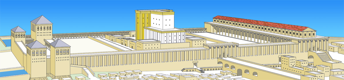
As storm clouds gather over Jerusalem and the Temple Mount, we continue with our series on the development of Mount Moriah.
In our previous post, we talked about the locations of the Altar and the Holy of Holies. What happened after David built the Altar? After ruling seven years in Hebron, he made Jerusalem the capital of Israel. The first thing he did was bring the Ark of the Covenant from Kiriath-jearim to Jerusalem, the City of David. There it rested, presumably in a tent in the grounds of David’s palace, until circa 967 BC .
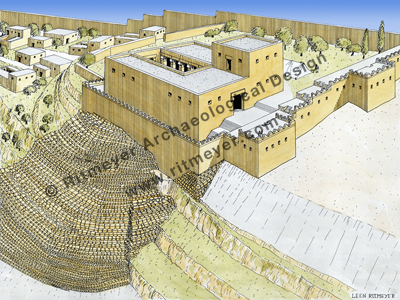
Here we see a reconstruction drawing of the Palace of King David. In the excavations of Yigal Shiloh, which took place between 1978-’84, a stepped stone structure was discovered that may have served as a foundation for David’s palace that stood higher up the hill. It stood behind the northern city wall and had rooms arranged round a courtyard. In the palace garden we see a tent for the Ark of the Covenant.
The Ark was then moved into the new temple that was built on Mount Moriah by Solomon, the son of David.
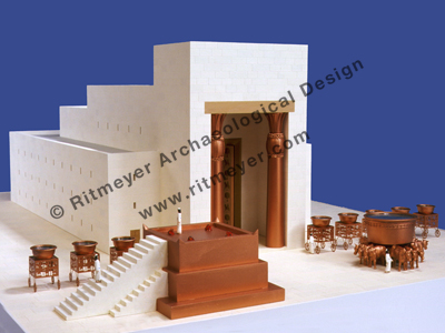
The design of this beautiful model of Solomon’s Temple is based on the description in the Book of Kings. The Temple had a high Porch, supported by two bronze pillars, called Yachin and Boaz. The inner sanctuary was divided into two rooms, the Holy Place and the Holy of Holies (Most Holy Place), where the Ark of the Covenant stood. A three-storey high structure surrounded the sanctuary. In front of the Temple stood the Altar, the bronze Basin (Sea) and ten smaller basins.
This sacred compound was surrounded by a wall that formed the Temple court.
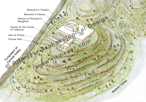
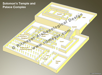
The Holy of Holies was placed on the summit of Mount Moriah, with the Temple facing east, toward the Mount of Olives. Solomon also built a palace complex adjacent to the Temple. It consisted of his armory, the House of the Forest of Lebanon, a Hall of Pillars, the Porch of the King’s Throne, the King’s House and the house of his wife, Pharaoh’s daughter. As our drawings concern Mount Moriah only, all other buildings and city walls have been omitted.
On the visit of the Queen of Sheba to Jerusalem (1 Kings 10), the Ascent which Solomon built from this complex up to the Temple, was one of the things that inspired her awe.
This schematic drawing shows an arrangement of the various buildings, based on parallels with similar complexes excavated elsewhere in the Middle East. From a large courtyard in front of Solomon’s House, a special Royal Ascent (1 Kings 10.5 KJV) led up to the Temple, which lay on higher ground.
For those of you who are interested, Carta very much hope to publish our guide book to the Temple Mount at the earliest propitious moment.
The first drawing in this series showed Mount Moriah itself.
The next drawing of Mount Moriah that was prepared for our new Temple Mount Guide Book (and now available in our Image Library) shows what the mount would have looked like in the Jebusite period. Araunah the Jebusite was the last pre-Israelite ruler of Jerusalem, or Jebus, as it was then called. At the end of the second millennium BC, the mountain was used for growing wheat and barley, as attested to by the reference to the threshing floor of Araunah in 1 Chronicles 21.15. After God had brought a plague on Israel, the angel of the Lord, who was about to destroy Jerusalem, told King David to build an altar on the threshing floor.
Mount Moriah during the Jebusite period. Wheat, barley and other crops were grown on the slopes of the mountain. The threshing floor where David built the altar was located a little to the east of the top of the mountain, indicated by the small protuberance, where the angel stood. This latter location became the place where Solomon built the Holy of Holies of his new Temple.
But where exactly was that threshing floor? Was it on the very top of Mount Moriah, i.e. on the Rock (Sakhra) now located inside the Dome of the Rock, or elsewhere? Many people believe the altar built by Abraham to sacrifice his son Isaac was situated on top of the Rock and that later the Temple altars were built there.
We have shown, however, that the Rock was the Foundation Stone for the Holy of Holies of Solomon’s Temple and all subsequent Temples and not the location of the altar.
A new reconstruction drawing of Solomon’s Temple, based on archaeological evidence and the description in 1 Kings 6. The Holy of Holies is placed on the Rock, which is actually the top of Mount Moriah and visible inside the Islamic Dome of the Rock. A special emplacement was cut in the rock for the Ark of the Covenant (1 Kings 8.6,21). The Altar stands on the threshing floor of Araunah, where David had previously built an altar (2 Sam. 24:18; 1Chr. 21:18).
We are told that the angel in 1 Chron. 21.16 was standing on higher ground, between heaven and earth as it were. That place was most likely the peak of Mount Moriah and the subsequent sanctity of the Rock is therefore derived from the presence of the angel.
The threshing floor must have been on lower ground to the east, to exploit the prevailing westerly winds to separate the chaff from the grain. Threshing floors are never located on the very top of mountains, as the strong westerly wind would blow away both chaff and grain, but always on lower ground, usually on the eastern side.
Jewish tradition maintains that David’s altar was built (c. 980 BC) on the same place that Abraham had erected his altar in preparation for the sacrifice of Isaac, before God intervened. Based on the relationship between Herod’s Temple and the Rock inside the Dome of the Rock, the altar would have been located just east of the Dome of the Chain, as depicted in this photograph:
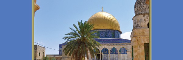
A view of the Dome of the Rock with the Dome of the Chain to its east. The Altar stood in the open space between the Dome of the Chain and the steps that lead up to the Raised Platform from the east.
However, when compiling our latest book, a Guide Book to the Temple Mount (forthcoming), a new set of drawings was necessary, the focus this time being on how Mount Moriah developed over time. The series begins with a drawing of the topography of Mount Moriah:
In the succeeding days, we will feature the following drawings of Mount Moriah in the historical periods from the Jebusites till the Early Muslim period.
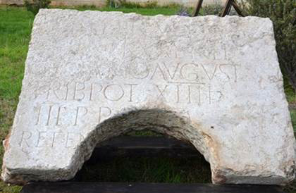
Today, the Israel Antiquities Authority revealed the “Rare Archaeological Find from the History of Jerusalem”, which we mentioned in yesterday’s blog post. It turns out to be a Roman inscription dating from 129/130 AD. It was dedicated by the 10th Legion (Fretensis ) to Hadrian, the Roman Emperor who rebuilt Jerusalem in 135 AD and renamed it Aelia Capitolina.
According to a report in Arutz Sheva, the inscription may be among “the most important Latin inscriptions ever discovered in Jerusalem.” The stone was found in secondary use as part of the cover of a deep cistern, hence the semi-circular hole that allowed the drawing of water.
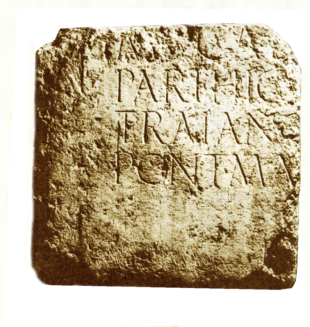
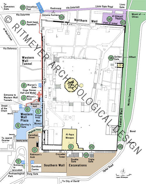
The stone that bears the inscription is actually the second part of an original inscription. The first part had already been discovered in Jerusalem by Clermont-Ganneau in the middle of the 19th century and is exhibited in the courtyard of the Studium Biblicum Fransciscanum Museum on the Via Dolorosa just inside the Lions (St. Stephen’s) Gate:Putting the two inscriptions together, the complete inscription reads:
“To the Imperator Caesar Traianus Hadrianus Augustus, son of the deified Traianus Parthicus, grandson of the deified Nerva, high priest, invested with tribunician power for the 14th time, consul for the third time, father of the country (dedicated by) the 10th legion Fretensis Antoniniana.”
After the Roman destruction of 70 A.D., the 10th Legion set up an encampment south of the Hippicus Tower on the Western Hill of Jerusalem. After nationalistic uprisings, Hadrian flattened the city and in 135 A.D. built a new one on its ruins and called it Aelia Capitolina.
The major buildings are the Damascus Gate in the north, a Temple of Aphrodite, two forums (market places) and there may have been a Temple of Jupiter on the Temple Mount.
Some historical sources indicate that during this Roman period, a sanctuary to Jupiter was erected on the Temple Mount as were two dedicatory columns with statues of Hadrian and Antoninus Pius. The remains of three long steps that are no longer visible but were marked on Warren’s plans, may have belonged to the southern part of the crepidoma (stepped platform) of this presumed temple. Jews were forbidden from entering the city on pain of death and Hadrian tried further to erase their connection to the Land by changing the name of Judea to Syria Palaestina (whence the name Palestine).
This drawing is one in the series that shows the history of Mount Moriah in the different historical phases starting at the time of Abraham. In future posts we will refer to other drawings in this series.
We promised to report on our new: “Jerusalem – The Temple Mount – A Carta Guide Book”. Incredibly, this is the first true guide book to the Temple Mount to be published since 1925, when the Supreme Muslim Council published their 12-page Brief Guide to al-Haram al-Sharif. In 2006 we published The Quest, Revealing the Temple Mount in Jerusalem. This is an academic work, but written and illustrated in such a way as to be accessible to scholars and laymen alike, detailing every nook and cranny of the Temple Mount in Jerusalem.
Our new guide book is completely different from The Quest. It has many new evocative reconstructive illustrations and is designed to help visitors understand what they are looking at, but is also invaluable for the person who cannot visit the Temple Mount in the flesh, but whose spirit is very much there.
In the Preface we wrote:
It is the authors’ sincere hope that this profusely illustrated guide book to the Temple Mount will help you to fully savor the experience of visiting a site that is truly without parallel and be embraced by its aura of power and sanctity. It is the culmination of years of academic work distilled into a user-friendly manual whose aim is to make the dry facts and stones come alive. If it can help you make this complex site more accessible and find your own personal spots for reflection, it will have fulfilled our vision. Each of the six distinct areas connected to the Temple Mount is preceded by a “Useful Information” section. Each route has its own detailed tour map. Of course, the tours can be done in whatever order you choose to do them in, including or omitting as you like.
Map of the 6 color coded areas
1. The Western Wall – Experience the Wall at the heart of Jerusalem (blue)
2. The Western Wall Tunnels – Follow the wall hidden in darkness (red)
3. Jerusalem Archaeological Park – Walk in the Park around the Southern Wall (brown)
4. The Eastern Wall – Deciphering the Puzzle of the Oldest of the Temple Mount Walls (green)
5. The Northern wall – Discovering the Hidden Wall (purple)
6. Going up to the Mountain of the House of the Lord (white)
The specialised maps at the end of the book provide additional information if you wish to focus on a particular aspect of the Temple Mount. One unique never-before-published map gives New Testament references that will allow you to follow in the footsteps of Jesus and his disciples around the Temple. The plan of the cisterns and underground structures will give you an idea of the magnitude of the vast world that lies beneath the Temple platform. The map of the Islamic structures will acquaint you with the gems of Muslim architecture all over the platform.
Many pages have sidebars containing fascinating tidbits of information on topics such as “Who was Melchizedek”, “What did the Queen of Sheba see?”, “What is the difference between a Menorah and a Hanukkiah?“, “What happens to the prayer notes left in the Western Wall?”? etc.
The book was due to have been published this month but is being delayed by the lack of tourists in Israel at the moment. Ironically, the fact that visitors are being deterred by the present situation and that when they do come, visiting hours are so restricted, makes the sort of virtual tour facilitated by this guide book all the more valuable.
As we wrote in our previous post, you can expedite the book’s speedy publication by using the online Contact Form to express interest to Carta.
The Temple Mount has been in turmoil recently. Every day there is some news about violence between Jews and Muslims on the Holy Mount. And the tourists are caught in the middle.
Ynetnews published an article today called “Powder keg on Temple Mount” which includes a video made during a visit to the Temple Mount. The situation on the Temple Mount is summarised like this:
While Muslim worshipers are allowed to enter the complex throughout the entire day, Jews are allowed entry as visitors (not worshipers) between 7:30 am and 11 am, only through the Mughrabi Bridge and under heavy police protection. Palestinians have grown aggrieved by the increasing number of visits to the site by Orthodox Jews, a program that is actively supported by Moshe Feiglin, an outspoken and far-right member of Prime Minister Benjamin Netanyahu’s Likud party.
The sounds of Jews singing and praying a few meters below, at the Western Wall and adjoining tunnels, permeate the Dome of the Rock plaza. The choirs of bearded men and veiled women in black compete for dominance with shouts and screams in Arabic of “Jews out! This place belongs to Muslims!
But the last paragraph caught our particular attention:
“Suddenly the screaming starts again. This time a group of women in black hijabs rushes amid cries of “Allahu Akbar” to expel a group of frightened-looking Israelis in secular dress, who are accompanied by a licensed guide who had dared to open a guide book in Hebrew.“
This brings us to the reason why we haven’t blogged for a while. Kathleen and I have been very busy updating two of our previous books and also writing a new Guide Book to the Temple Mount, called “Jerusalem – The Temple Mount, A Carta Guide”. Over the coming days we will report on these books and especially on our new Guide Book. This latest book is completely ready for publication, but the publisher is holding back because there are so few tourists in the country! The first guide book to this unique site since 1925 is ready to roll off the printing press… if only the tourists will show up!
We have just been told that if Carta gets enough interest for our book, they will go to print!!
The publisher is awaiting expressions of interest, so, we’d appreciate it if you’d fill in the contact form, expressing interest in our book. Thank you!
Nadav Shagrai wrote a lengthy article, called A Heart of Stone, in Israel Hayom about the amazing feat of tunneling deep underground along the foundations of the Western Wall by Eli Shukron and his team. This uncovering has undoubtedly increased our understanding of how this mighty wall, and indeed all other walls too, were constructed. It was reported earlier that some coins dating from about 17-18 CE had been found in the fill of a mikveh below the Western Wall. This find was used to suggest that not Herod the Great, but one or more of his sons completed the project.
This stretch of foundation stones of the Western Wall is located right next to the main drain that runs the full length of the Herodian street that began at the Damascus Gate and ended at the southern gate near the Siloam Pool. One doesn’t need much imagination to understand that maintenance work would have frequently been carried out in and near the drain during the long period that it was in use. The filling in of the above mentioned mikveh, that was located in between the drain and the foundation of the Western Wall, could have been carried out during such work.
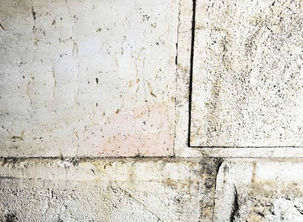
It is now also reported that one of the Herodian foundation stones had no margins, but a smooth finish. This what Eli has to say:
Photo of the smooth stone at upper left. Photo credit: Vladimir Neichin
“This stone came from the Temple Mount, from the surplus stones that were used in the construction of the Temple itself. Those stones were high-quality, chiseled and smooth, like this unusual one, which was discovered among the Western Wall’s foundations. This stone was intended for the Second Temple, and stones like it were used to build the Temple — but it was left unused. The builders of the Western Wall brought it down here because it was no longer needed up above — and this is how the other stones of the Temple looked,” he says, adding, “Anyone who passes a hand gently over this stone feels a slightly wavy texture, just like the Talmud describes.”
It is true that all the external faces of the Herodian stones have margins on all four sides, apart from this unique stone. The suggestion that this particular stone could have come from the Temple itself would have been a possibility if only the stones that were used to build the Temple had a smooth finish. That, however, is not the case. In studying Herodian architecture, one needs to differentiate between external and internal finishes of the stones. The internal parts of the stones that make up the retaining walls were never seen and therefore were roughly squared on the inside. The stones of the Western Wall above the level of the Temple Mount could be seen from inside the porticoes that were built all around. The interior finish of these stones was smooth. Several of these stones were found in the Temple Mount Excavations. One such stone was later reused in a Byzantine building. That stone was a pilaster stone, part of the outer wall of the porticoes that ran above the Temple Mount retaining walls. These stones had an external finish with margins, like the ones we see today, and a smooth internal finish. From the inside therefore, the portico wall looked smooth. It is quite possible, and indeed more likely, that the newly discovered smooth stone came from the porticoes and not necessarily from the Temple itself.
It is necessary to exercise caution before suggesting that this smooth stone must have come from the Temple. Although it is exciting to find the first in situ stone without margins, one needs to be careful not to draw unwarranted conclusions.
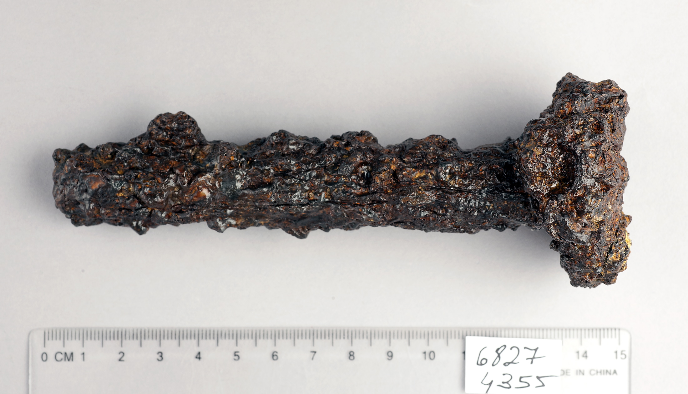
In today’s Ha’aretz newspaper, Nir Hasson reports on the finding of a chisel that dates back to the building of Herod’s Temple Mount. It was found at the base of the Western Wall, some 6 meters below the Herodian street. It certainly looks like a chisel that masons used to carve stones with. The flattened head was caused, not from “being repeatedly banged on rock”, but by the hammer that was used by the masons.
Photo by Clara Amit, Israel Antiquities Authority
Shukron who excavates the Herodian drain beneath Robinson’s Arch, said:
It is true that the rocks comprising the Western Wall had been transported there from far away. But the final work on the giant stones, and the job of fitting them with incredible precision, were done on site.
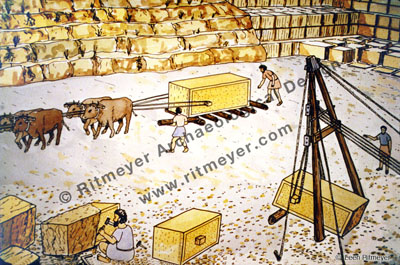
One wouldn’t use chisels, however, to fit the stones together. That was done by cranes and levers. The stones of the Temple Mount walls were completely finished in the quarry and then transported to the building site.
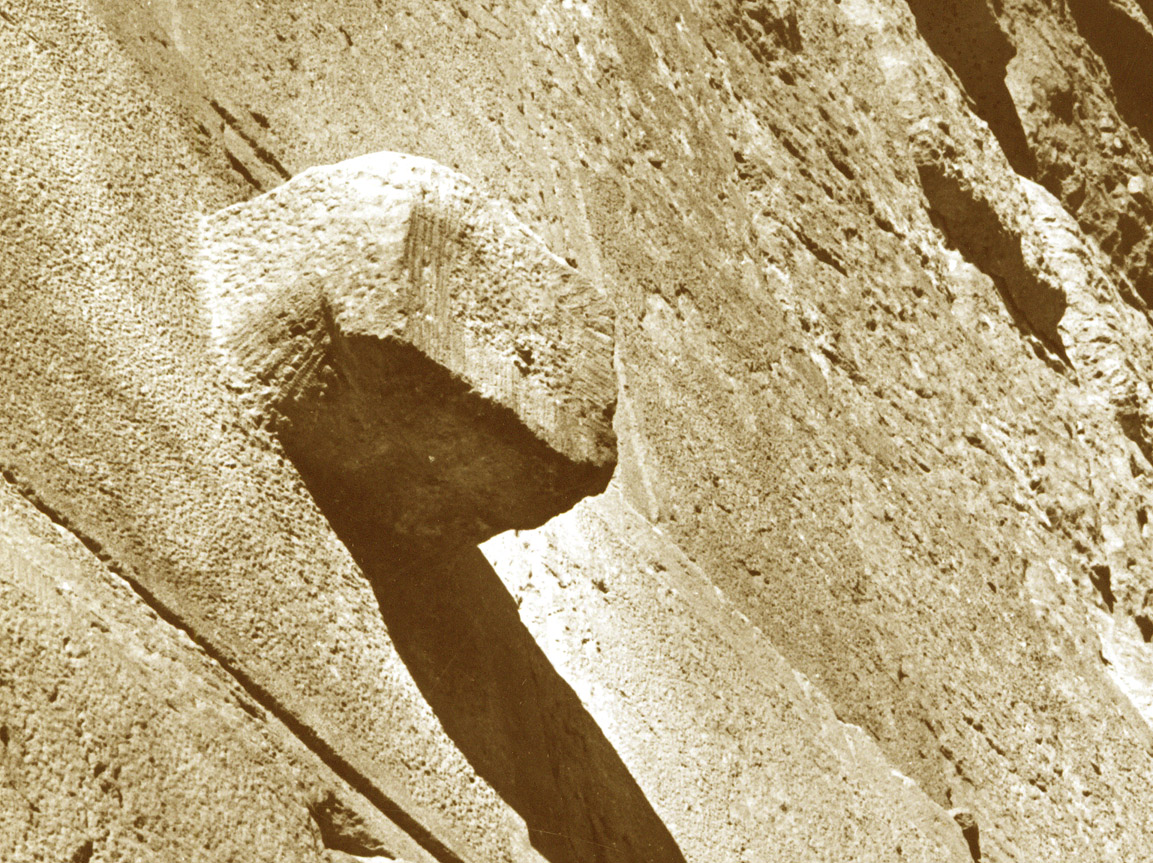
To lift the stones, the masons left small projections on the side of the stones, and those were cut off once the stones were in place. The short chisel that was found, would have been eminently suitable for that job.
A projection, used to lift the stones. They were chiselled off once the stone was in place. This knob on one of the stones of the Eastern Wall, however, survived. Perhaps it was forgotten or the scaffolding had been prematurely taken down.
Although coins from the beginning of the first century were found, that does not necessarily indicate that the Western Wall was finished after Herod’s death. If that would have been the case, then the Royal Stoa must have been built later too. None of Herod’s sons would have had the means or the vision to complete the building of the southern part of the Temple Mount. These coins were probably dropped later by workmen doing maintenance or repair works to the Herodian drain.
The giant newsreel archive British Pathé, released its entire collection of 85,000 films to the public this week.
The films, dating from 1896 to 1976, include hundreds of newsreels from Palestine prior to the establishment of Israel in 1948. We found of particular interest the films of combat between British and Turkish forces during World War I and the brave attempts to push desperate Jewish refugees from Europe past British barriers in the 1930s and 40s.
“This unprecedented release of vintage news reports and cinemagazines is part of a drive to make the archive more accessible to viewers all over the world,”British Pathé announced.
“Our hope is that everyone, everywhere who has a computer will see these films and enjoy them,” said Alastair White, General Manager of British Pathé. “This archive is a treasure trove unrivalled in historical and cultural significance that should never be forgotten. Uploading the films to YouTube seemed like the best way to make sure of that.”
We present here several of the exciting films now on the British Pathé YouTube collection. Many of the newsreels are silent films.
The ones shown on the website are:
Dedication of the Hebrew University and speech by Earl Arthur Balfour (1925)
1929 disturbances against Jews, a crude Jewish barricade, and the arrival of aBritish naval ship in an attempt to restore order.
Thousands of American Jews take part in [1929 “monster”] demonstration before offices of the British Consul, demanding protection for their kinsmen in Palestine. New York, U.S.
“In Palestine Today (1938)” shows how the British restored peace in Jerusalem with the loss of “only” 9 people:
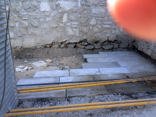
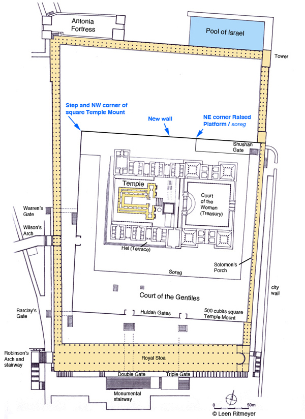
Recently, the ground level near the new generator room north of the raised platform was lowered by one foot. This work exposed an unknown course of stones from an earlier phase of this wall. This course could be dated to the Early Umayyad period or even the Herodian Period. L. Ritmeyer suggested that the foundation of this course was the original northern wall of the Temple Mount, and there is evidence for this thesis in various spots along this line.
Zachi sent me a photograph showing a line of large stones below the northern wall of the raised platform.
The newly discovered stones are below the platform wall at the back of the picture. New paving is being laid against it. Photo: Zachi Dvira
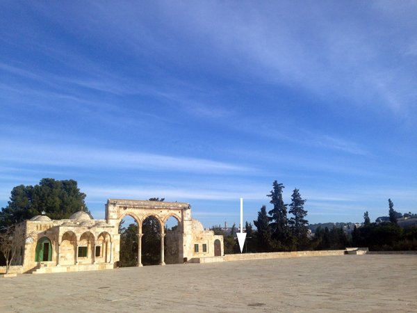
Needing more information, I asked a friend of Nathaniel, one of my sons, to send me additional photographs showing what is happening on the Temple Mount at present. The location in question is to the east of the eastern stairway that leads up to the raised platform from the north:
Looking northeast, the site in question is behind and below the wall where the arrow points
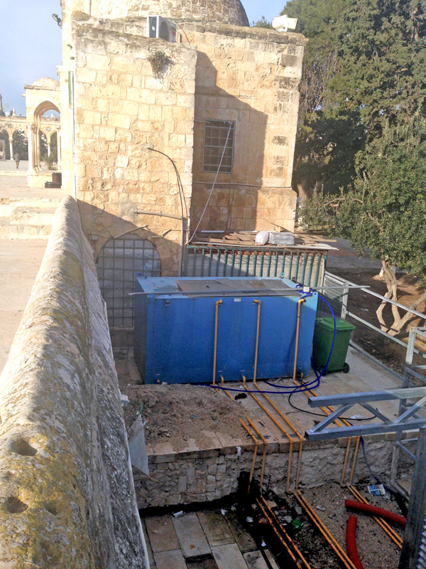
In the following picture, we see the area below the blue container that was lowered by about 1m. (3 feet):
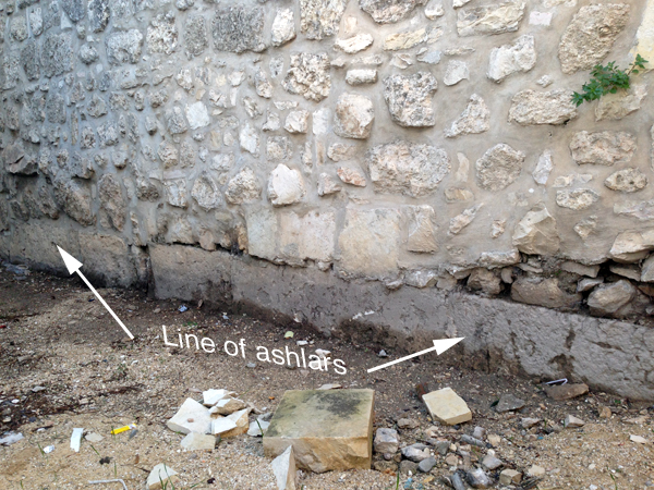
The area in lower foreground has been lowered, exposing a line of ancient ashlars at the foot of the platform wall on the left.
The following photograph shows the single course of beautifully carved ashlars (large stones):
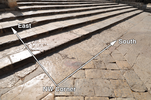
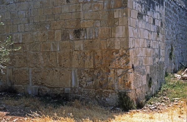
It is difficult to say when this monumental masonry was built, but it is located along the line of the northern wall of the raised platform, which we had previously (The Quest, pp. 165-186) identified as the northern boundary of the pre-Herodian Temple Mount. To the west of this same line is the northwest corner of the 500-cubit square Temple Mount of the First Temple period and we had suggested that this was built by King Hezekiah:
The masonry at the northwest corner of the square Temple Mount is characterised by rough bosses, while the other two sections have smooth masonry. It is possible that these two sections were built at a later time, above earlier masonry.
Reviewing the discovery of this new wall, we can see that it lies on the northern boundary of the ancient Temple Mount. It is unlikely that this wall was built in the Umayyad period as no other masonry of this calibre can be seen anywhere in the outer walls of the raised platform. No major building projects were carried out on the Temple Mount in the Byzantine period. That leaves us with either the Roman (Aelia Capitolina) or the Herodian period. Although we cannot prove it, the latter would be an exciting possibility! In any case, the fact that monumental masonry is built on the northern boundary of the ancient Temple Mount appears to confirm the location of the square Temple Mount of the First Temple period.
All this goes to show that many more archaeological remains may still be hidden below the surface of the Temple platform and how much more we could learn if excavations were made possible! This would be extremely valuable, as only excavation would make it possible to identify the period of these wall remains.